Landsat mosiac of North & South Korea
Numéro d’image : 11736029
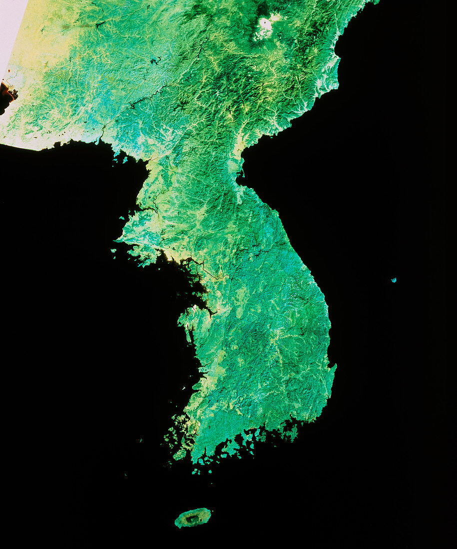
| Satellite image of North and South Korea. The colours in this image have been processed to approximate to true colour. All of the peninsula is seen covered in green: dark green mountainous vegetation or lighter green lowland scrub. On the thin black line of a river near centre frame is a small brown patch - this is Seoul,capital of South Korea. The border between North and South Korea runs from just below the triangular promontory on the left (west) coast toward the upper right,straddling the 38 degrees south latitude line defined at the end of the Korean War of the 1950s. This image is a mosaic of frames made by a Landsat satellite | |
| Licence : | Droits gérés |
| Crédit: | Science Photo Library / Restec, Japan |
| Taille de l’image : | 4408 px × 5299 px |
| Model Release : | Non requis |
| Property Release : | Non requis |
| Restrictions : |
|
Prix pour cette image À partir de 45 €
Produit vendu
(Calendrier, Carte postale, Carte de vœux, Impression sur textile, Packaging etc)
À partir de 45 €
Usage commercial
(Affichage, Annonce presse, Annonce TV, Carte, Digital - hors rés. sociaux, Digital - rés. sociaux etc)
À partir de 45 €
Éditorial
(Digital, Journal, Livre, Livre pratique, Magazine, Télévision etc)
À partir de 60 €
Usage non-commercial
(Digital - hors rés. sociaux, Digital - rés. sociaux etc)
À partir de 120 €