Coloured satellite image of Eurasia at night
Numéro d’image : 11735986
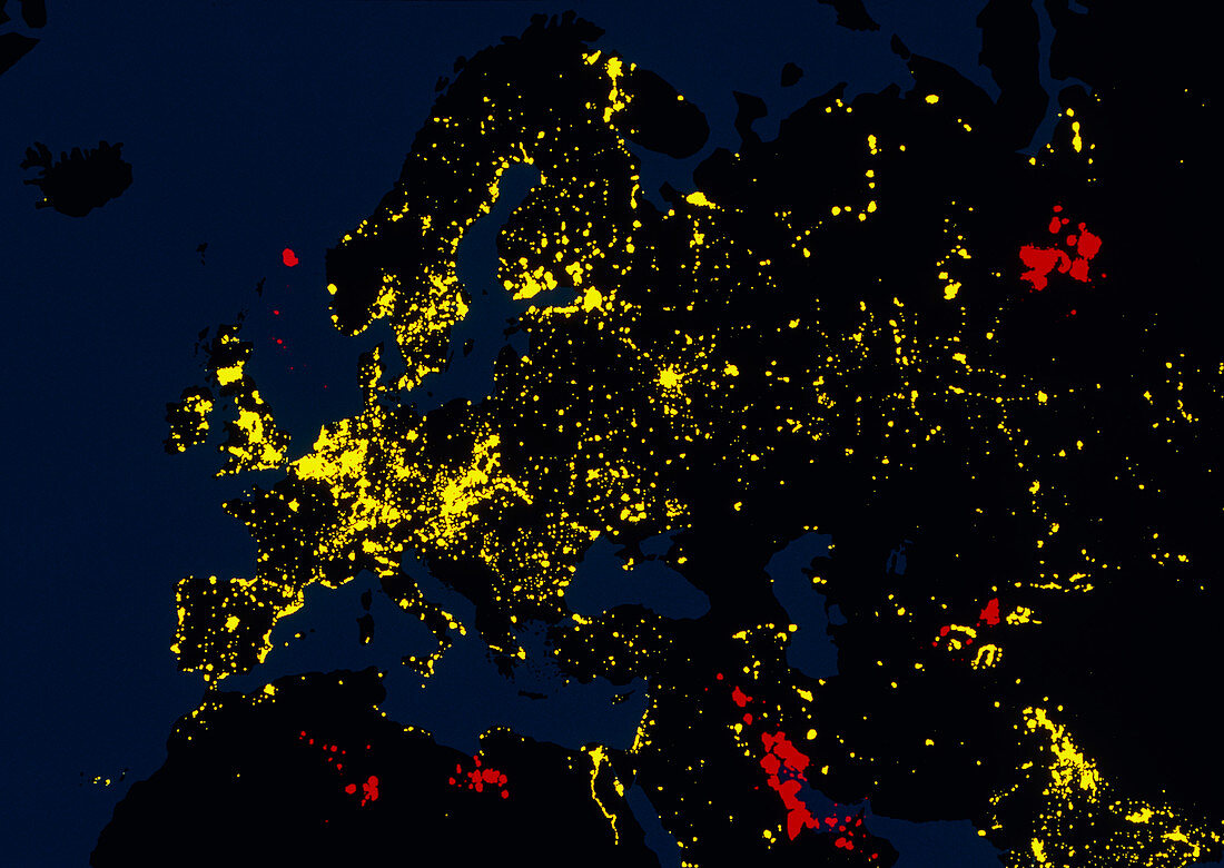
| Eurasia at night from space. Colour-coded image,based on satellite data,of Eurasia at night. North is at top. Seen here are Europe (centre left),Asia (right) and North Africa (lower left). In this image,city lights appear yellow,flares from oil production areas are red and burning vegetation is purple. Most of the light comes from cities. Europe and India (at bottom right) are the most heavily populated regions. The data for this picture was produced as a mosaic of images from the American Defense Meteorological Satellite Program (DMSP) spacecraft | |
| Licence : | Droits gérés |
| Crédit: | Science Photo Library / Sullivan, W.T. |
| Taille de l’image : | 3543 px × 2512 px |
| Model Release : | Non requis |
| Property Release : | Non requis |
| Restrictions : | - |
Prix pour cette image À partir de 45 €
Produit vendu
(Calendrier, Carte postale, Carte de vœux, Impression sur textile, Packaging etc)
À partir de 45 €
Usage commercial
(Affichage, Annonce presse, Annonce TV, Carte, Digital - hors rés. sociaux, Digital - rés. sociaux etc)
À partir de 45 €
Éditorial
(Digital, Journal, Livre, Livre pratique, Magazine, Télévision etc)
À partir de 60 €
Usage non-commercial
(Digital - hors rés. sociaux, Digital - rés. sociaux etc)
À partir de 120 €
Mots clés
- Afrique,
- de l'espace,
- éclairage de ville,
- Eurasie,
- Europe,
- image du programme de satellites météorologiques de la Défense,
- lampadaires,
- léger,
- lumières,
- lumières de la ville depuis l'espace,
- lumières de ville de l'espace,
- Moyen Orient,
- Moyen-Orient,
- nord,
- nuit,
- science de la terre,
- sciences,
- terre,
- ville,
- villes