Satellite picture of the Americas at night
Numéro d’image : 11735960
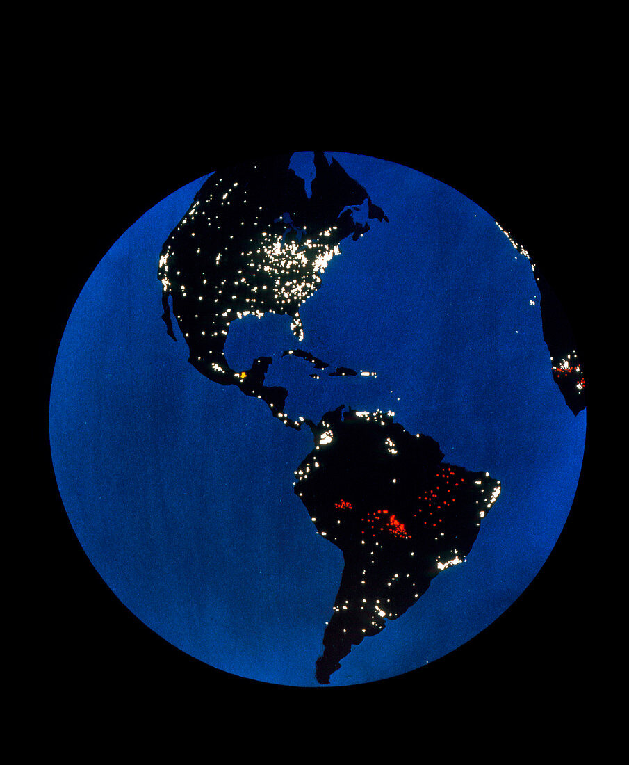
| Satellite image of the Americas at night. The white patches indicate city lights,and thus the distribution of urbanisation across the continent. The red spots across part of South America indicate large-scale burning of vegetation. The small yellow spot in Central America shows burning gas flares at oil production sites. Toward the top right may be seen white city lights in Europe,with cities and red spots of vegetation burning in Africa at far right. The image was recorded by the visible/infrared Operational Linescan System onboard a Defense Meteorological Satellite Program (DMSP) spacecraft | |
| Licence : | Droits gérés |
| Crédit: | Science Photo Library / NASA |
| Taille de l’image : | 2915 px × 3543 px |
| Model Release : | Non requis |
| Property Release : | Non requis |
| Restrictions : | - |
Prix pour cette image À partir de 45 €
Produit vendu
(Calendrier, Carte postale, Carte de vœux, Impression sur textile, Packaging etc)
À partir de 45 €
Usage commercial
(Affichage, Annonce presse, Annonce TV, Carte, Digital - hors rés. sociaux, Digital - rés. sociaux etc)
À partir de 45 €
Éditorial
(Digital, Journal, Livre, Livre pratique, Magazine, Télévision etc)
À partir de 60 €
Usage non-commercial
(Digital - hors rés. sociaux, Digital - rés. sociaux etc)
À partir de 120 €