Northern Tunisia
Numéro d’image : 11735848
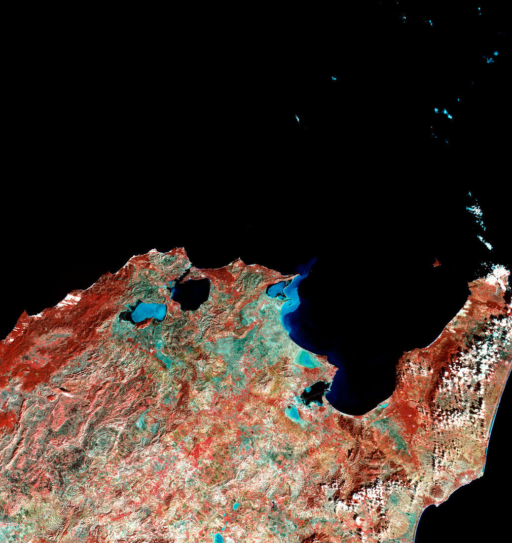
| Tunisia. Combined infrared and optical satellite image of northern Tunisia showing Tunis,the capital city. North is at top. Tunis is on the small black Lac de Tunis at the southwestern edge of the Gulf of Tunis (the large triangular bay at centre right). Water is black and blue here,and clouds are white. Two salt lakes (light blue) are seen to the north and just to the south of Tunis. At centre left,the town of Bizerte lies at the northernmost headland of the country. Photographed by Landsat 1 on 9th November 1972 | |
| Licence : | Droits gérés |
| Crédit: | Science Photo Library / MDA Information Systems |
| Taille de l’image : | 4125 px × 4370 px |
| Model Release : | Non requis |
| Property Release : | Non requis |
| Restrictions : | - |
Prix pour cette image À partir de 45 €
Produit vendu
(Calendrier, Carte postale, Carte de vœux, Impression sur textile, Packaging etc)
À partir de 45 €
Usage commercial
(Affichage, Annonce presse, Annonce TV, Carte, Digital - hors rés. sociaux, Digital - rés. sociaux etc)
À partir de 45 €
Éditorial
(Digital, Journal, Livre, Livre pratique, Magazine, Télévision etc)
À partir de 60 €
Usage non-commercial
(Digital - hors rés. sociaux, Digital - rés. sociaux etc)
À partir de 120 €