Europe
Numéro d’image : 11735737
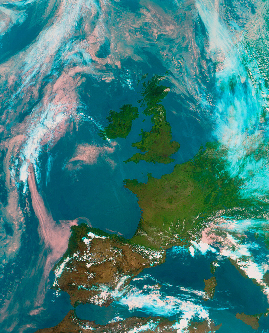
| Europe. Satellite image of Europe. North is at top. The image approximates to true colours with land appearing green,water dark blue and clouds white,pink and pale blue. The British Isles (upper centre) lie off the coast of France,with Spain at lower left. Italy (lower right),eastern Europe and Scandinavia (upper right) are covered in cloud. This image was taken by the American NOAA-14 weather satellite on July 17 1996 | |
| Licence : | Droits gérés |
| Crédit: | Science Photo Library / University of Dundee |
| Taille de l’image : | 4093 px × 5058 px |
| Model Release : | Non requis |
| Property Release : | Non requis |
| Restrictions : | - |
Prix pour cette image À partir de 45 €
Produit vendu
(Calendrier, Carte postale, Carte de vœux, Impression sur textile, Packaging etc)
À partir de 45 €
Usage commercial
(Affichage, Annonce presse, Annonce TV, Carte, Digital - hors rés. sociaux, Digital - rés. sociaux etc)
À partir de 45 €
Éditorial
(Digital, Journal, Livre, Livre pratique, Magazine, Télévision etc)
À partir de 60 €
Usage non-commercial
(Digital - hors rés. sociaux, Digital - rés. sociaux etc)
À partir de 120 €