Europe
Numéro d’image : 11735735
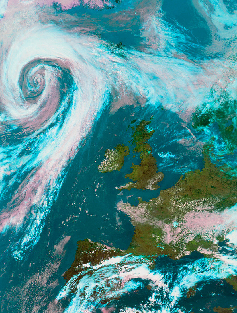
| Europe. Satellite image of Europe. North is at top. The image approximates to true colours with land appearing green,water blue and clouds white/ pink. Britain and Ireland lie off the coast of France (lower right) with Spain at bottom centre. Swirling clouds mark the position of a depression or cyclone,an area of low atmospheric pressure,in the Atlantic Ocean at upper left. A cloudless area of high pressure,an anticyclone,lies over the British Isles. Anticyclones bring settled dry sunny weather,while changeable wet windy weather is characteristic of depressions. This image was taken by the American NOAA-14 weather satellite at 13:26 Greenwich Mean Time on August 9 1995 | |
| Licence : | Droits gérés |
| Crédit: | Science Photo Library / University of Dundee |
| Taille de l’image : | 3795 px × 5020 px |
| Model Release : | Non requis |
| Property Release : | Non requis |
| Restrictions : | - |
Prix pour cette image À partir de 45 €
Produit vendu
(Calendrier, Carte postale, Carte de vœux, Impression sur textile, Packaging etc)
À partir de 45 €
Usage commercial
(Affichage, Annonce presse, Annonce TV, Carte, Digital - hors rés. sociaux, Digital - rés. sociaux etc)
À partir de 45 €
Éditorial
(Digital, Journal, Livre, Livre pratique, Magazine, Télévision etc)
À partir de 60 €
Usage non-commercial
(Digital - hors rés. sociaux, Digital - rés. sociaux etc)
À partir de 120 €