Satellite image of the Arabian Peninsula
Numéro d’image : 11735731
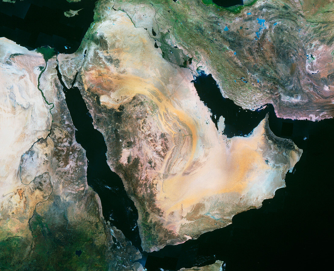
| Arabian Peninsula. Satellite image of the Arabian Peninsula. North is at top. The colours approxim- ate to real tones with vegetation green,water black and bare ground pink,brown,grey and yellow. At centre is the Arabian Peninsula mainly comprising Saudi Arabia,bordered by the Red Sea (lower left),the Persian Gulf (centre right) and the Arabian Sea (bottom right). This area is mainly sandy and rocky desert. Also seen is the Mediterranean Sea (top left) and Iran (upper right). Africa is at lower left with the Nile river below the Nile delta (green,upper left). This image is from an American Landsat satellite | |
| Licence : | Droits gérés |
| Crédit: | Science Photo Library / MDA Information Systems |
| Taille de l’image : | 4705 px × 3824 px |
| Model Release : | Non requis |
| Property Release : | Non requis |
| Restrictions : | - |
Prix pour cette image À partir de 45 €
Produit vendu
(Calendrier, Carte postale, Carte de vœux, Impression sur textile, Packaging etc)
À partir de 45 €
Usage commercial
(Affichage, Annonce presse, Annonce TV, Carte, Digital - hors rés. sociaux, Digital - rés. sociaux etc)
À partir de 45 €
Éditorial
(Digital, Journal, Livre, Livre pratique, Magazine, Télévision etc)
À partir de 60 €
Usage non-commercial
(Digital - hors rés. sociaux, Digital - rés. sociaux etc)
À partir de 120 €