Asia
Numéro d’image : 11735709
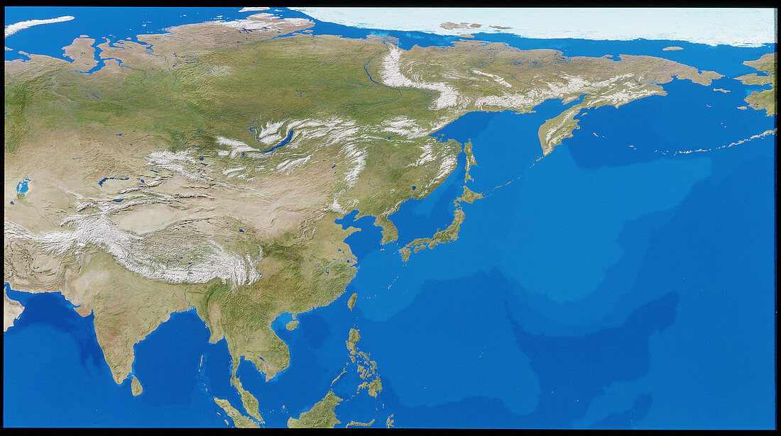
| Asia. Cloudless satellite image of Asia in flat projection; this exaggerates east-west distances in the northernmost part of the image (at top). The colours of the land approximate to natural tones,whilst blue colour-codes represent ocean topography. The snow-capped Himalaya mountains are at lower left. To the northeast of the Himalayas is the Gobi desert. This image was compiled from data acquired by NOAA weather satellites over eleven ten-day periods at an altitude of 833 kilometres to give a resolution of 1 kilometre | |
| Licence : | Droits gérés |
| Crédit: | Science Photo Library / PLANETARY VISIONS / TOM VAN SANT, GEOSPHERE PROJECT |
| Taille de l’image : | 5142 px × 2873 px |
| Model Release : | Non requis |
| Property Release : | Non requis |
| Restrictions : |
|
Prix pour cette image À partir de 45 €
Produit vendu
(Calendrier, Carte postale, Carte de vœux, Impression sur textile, Packaging etc)
À partir de 45 €
Usage commercial
(Affichage, Annonce presse, Annonce TV, Carte, Digital - hors rés. sociaux, Digital - rés. sociaux etc)
À partir de 45 €
Éditorial
(Digital, Journal, Livre, Livre pratique, Magazine, Télévision etc)
À partir de 60 €
Usage non-commercial
(Digital - hors rés. sociaux, Digital - rés. sociaux etc)
À partir de 120 €