Infrared satellite image of southern Florida,USA
Numéro d’image : 11735703
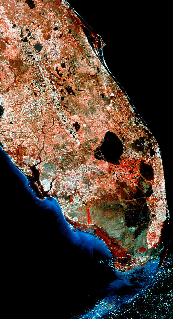
| Florida. Infrared satellite image of southern Florida,USA. North is at top. In the infrared range vegetation appears red,buildings are grey,water is black and sand banks & reefs are light blue. At the tip of the Florida peninsula are the Everglades,a swampy area kept wet by regular overflows from Lake Okeechobee (at centre right). To the east of the Everglades is Miami. Projecting from top centre is Cape Canaveral,the launch site for America's space programme. The string of islands to the south of the peninsula are the Florida Keys. Image taken by the American Landsat satellite | |
| Licence : | Droits gérés |
| Crédit: | Science Photo Library / MDA Information Systems |
| Taille de l’image : | 3216 px × 5930 px |
| Model Release : | Non requis |
| Property Release : | Non requis |
| Restrictions : | - |
Prix pour cette image À partir de 45 €
Produit vendu
(Calendrier, Carte postale, Carte de vœux, Impression sur textile, Packaging etc)
À partir de 45 €
Usage commercial
(Affichage, Annonce presse, Annonce TV, Carte, Digital - hors rés. sociaux, Digital - rés. sociaux etc)
À partir de 45 €
Éditorial
(Digital, Journal, Livre, Livre pratique, Magazine, Télévision etc)
À partir de 60 €
Usage non-commercial
(Digital - hors rés. sociaux, Digital - rés. sociaux etc)
À partir de 120 €