North America
Numéro d’image : 11735680
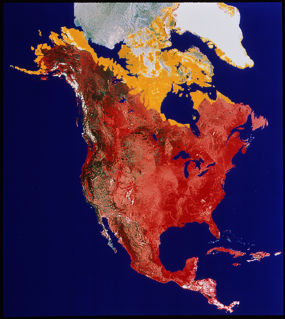
| North America. Coloured satellite image of the continent of North America. This is a mosaic of several frames gathered by NOAA weather satellites. The red colours represent different types of temperate vegetation. The rich reds in the east (right) and south represent lush grass and forest. The paler,browner reds in the centre show prairie regions,whilst the deep brown of the upper left are coniferous forests. The yellow colours at top indicate the extent of the Arctic tundra,a treeless region with permafrost soil. At top centre is sea ice (grey),and at top right is snow-covered Greenland. Also seen are Central America and the islands of the Caribbean Sea | |
| Licence : | Droits gérés |
| Crédit: | Science Photo Library / NRSC / BP |
| Taille de l’image : | 3628 px × 4060 px |
| Model Release : | Non requis |
| Property Release : | Non requis |
| Restrictions : | - |
Prix pour cette image À partir de 45 €
Produit vendu
(Calendrier, Carte postale, Carte de vœux, Impression sur textile, Packaging etc)
À partir de 45 €
Usage commercial
(Affichage, Annonce presse, Annonce TV, Carte, Digital - hors rés. sociaux, Digital - rés. sociaux etc)
À partir de 45 €
Éditorial
(Digital, Journal, Livre, Livre pratique, Magazine, Télévision etc)
À partir de 60 €
Usage non-commercial
(Digital - hors rés. sociaux, Digital - rés. sociaux etc)
À partir de 120 €
Mots clés
- Alaska,
- Amérique Centrale,
- Amérique du Nord,
- ampleur,
- Canada,
- cartographie,
- continent,
- Cuba,
- de l'espace,
- Etats-Unis,
- étendue,
- Floride,
- géographie,
- Golfe du Mexique,
- grands Lacs,
- image satellite,
- imagerie satellitaire,
- imagerie satellite,
- images,
- Mer des Caraïbes,
- mesure,
- Mexique,
- photo,
- photos,
- science de la terre,
- sciences,
- toundra,
- USA