Gulf of Mexico,satellite mosaic
Numéro d’image : 11735671
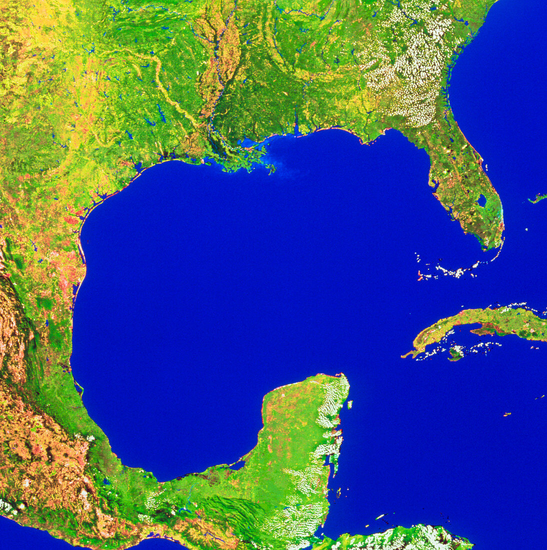
| Gulf of Mexico. Mosaic of satellite images showing the area around the Gulf of Mexico. The land at the top of the frame is in the southern USA. In the middle of the coast is the vast delta of the Mississippi River,and at right is the Florida peninsula. Most of the left of the frame is in Mexico,with the volcanic mountains of the Sierra Madre seen clearly in brown. At bottom centre is the Yucatan peninsula of Central America. The large island at centre right is Cuba. The data for this image were gathered by NOAA weather satellites | |
| Licence : | Droits gérés |
| Crédit: | Science Photo Library / Worldsat International |
| Taille de l’image : | 3523 px × 3543 px |
| Model Release : | Non requis |
| Property Release : | Non requis |
| Restrictions : |
|
Prix pour cette image À partir de 45 €
Produit vendu
(Calendrier, Carte postale, Carte de vœux, Impression sur textile, Packaging etc)
À partir de 45 €
Usage commercial
(Affichage, Annonce presse, Annonce TV, Carte, Digital - hors rés. sociaux, Digital - rés. sociaux etc)
À partir de 45 €
Éditorial
(Digital, Journal, Livre, Livre pratique, Magazine, Télévision etc)
À partir de 60 €
Usage non-commercial
(Digital - hors rés. sociaux, Digital - rés. sociaux etc)
À partir de 120 €