Satellite mosaic of the Mediterranean Sea
Numéro d’image : 11735670
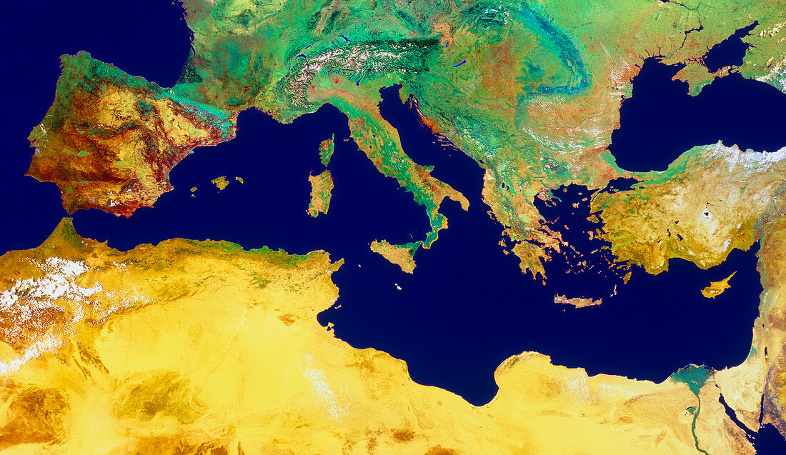
| The Mediterranean Sea,from space. Mosaic of satellite images showing the region around the Mediterranean Sea. The sea forms a boundary between the largely green and fertile south of Europe (top) and the yellows and browns of arid North Africa and the Middle East. The sea occupies a tectonic boundary between the Eurasian and African plates. Extensive mountain building has resulted,including the Alps (top centre) and the Atlas Mountains (centre left). Volcanoes are still active in Italy and Sicily (centre),whilst earthquakes are common in Turkey (centre right). The data for this image were gathered by NOAA weather satellites | |
| Licence : | Droits gérés |
| Crédit: | Science Photo Library / Geospace |
| Taille de l’image : | 6146 px × 3557 px |
| Model Release : | Non requis |
| Property Release : | Non requis |
| Restrictions : | - |
Prix pour cette image À partir de 45 €
Produit vendu
(Calendrier, Carte postale, Carte de vœux, Impression sur textile, Packaging etc)
À partir de 45 €
Usage commercial
(Affichage, Annonce presse, Annonce TV, Carte, Digital - hors rés. sociaux, Digital - rés. sociaux etc)
À partir de 45 €
Éditorial
(Digital, Journal, Livre, Livre pratique, Magazine, Télévision etc)
À partir de 60 €
Usage non-commercial
(Digital - hors rés. sociaux, Digital - rés. sociaux etc)
À partir de 120 €