Southern Europe and Mediterranean Sea
Numéro d’image : 11735651
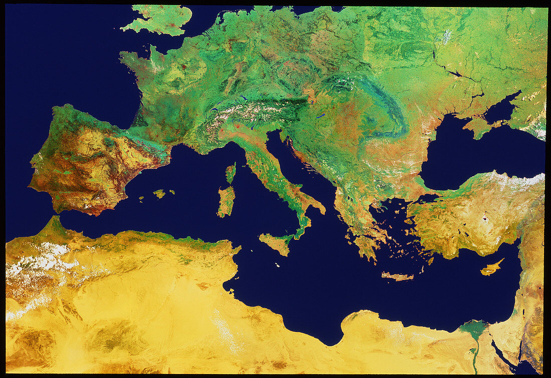
| Mediterranean Sea. Mosaic of satellite images showing the Mediterranean Sea. the colours of the image have been exaggerated to show surface cover: pale/mid-green denotes grassland and deciduous forest,dark green shows coniferous forest,pale brown depicts sparse arid vegetation and yellow denotes desert. Points of interest include the Alps (just above centre,white),the Black Sea (centre right),and the Nile Delta (green,lower right). The data for this image were gathered by NOAA weather satellites | |
| Licence : | Droits gérés |
| Crédit: | Science Photo Library / Geospace |
| Taille de l’image : | 4641 px × 3185 px |
| Model Release : | Non requis |
| Property Release : | Non requis |
| Restrictions : | - |
Prix pour cette image À partir de 45 €
Produit vendu
(Calendrier, Carte postale, Carte de vœux, Impression sur textile, Packaging etc)
À partir de 45 €
Usage commercial
(Affichage, Annonce presse, Annonce TV, Carte, Digital - hors rés. sociaux, Digital - rés. sociaux etc)
À partir de 45 €
Éditorial
(Digital, Journal, Livre, Livre pratique, Magazine, Télévision etc)
À partir de 60 €
Usage non-commercial
(Digital - hors rés. sociaux, Digital - rés. sociaux etc)
À partir de 120 €
Mots clés
- Autriche,
- Balkans,
- Chypre,
- Crète,
- Croatie,
- de l'espace,
- Espagne,
- Europe,
- France,
- géographie,
- Grèce,
- image satellite,
- imagerie satellitaire,
- imagerie satellite,
- images,
- Italie,
- méditérranéen,
- mer,
- mer adriatique,
- Mer Méditérrannée,
- photo,
- photos,
- Portugal,
- science de la terre,
- sciences,
- Slovénie,
- Sud,
- Suisse,
- Tunisie,
- Yougoslavie