False-colour satellite picture of Italy
Numéro d’image : 11735622
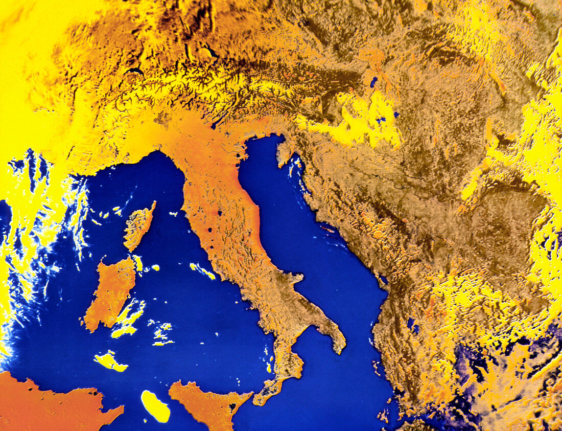
| False-colour satellite image of Italy produced from a DMSP (Defense Meteorological Satellite Program) film transparency. Taken on May 29th 1979,the picture also shows Sicily (bottom),Corsica & Sardinia (left),Tunisia (lower left),Switzerland & Austria (top),and Yugoslavia & Albania (right). The band of rugged terrain visible just above Italy is the Alps,the snow cover appearing in yellow. The dark region in the top right hand corner of Sicily is Mount Etna,the highest volcano in Europe | |
| Licence : | Droits gérés |
| Crédit: | Science Photo Library / NSIDC / NOAA |
| Taille de l’image : | 3543 px × 2716 px |
| Model Release : | Non requis |
| Property Release : | Non requis |
| Restrictions : | - |
Prix pour cette image À partir de 45 €
Produit vendu
(Calendrier, Carte postale, Carte de vœux, Impression sur textile, Packaging etc)
À partir de 45 €
Usage commercial
(Affichage, Annonce presse, Annonce TV, Carte, Digital - hors rés. sociaux, Digital - rés. sociaux etc)
À partir de 45 €
Éditorial
(Digital, Journal, Livre, Livre pratique, Magazine, Télévision etc)
À partir de 60 €
Usage non-commercial
(Digital - hors rés. sociaux, Digital - rés. sociaux etc)
À partir de 120 €