Shuttle photograph of Kuwait,Iraq & Iran
Numéro d’image : 11735619
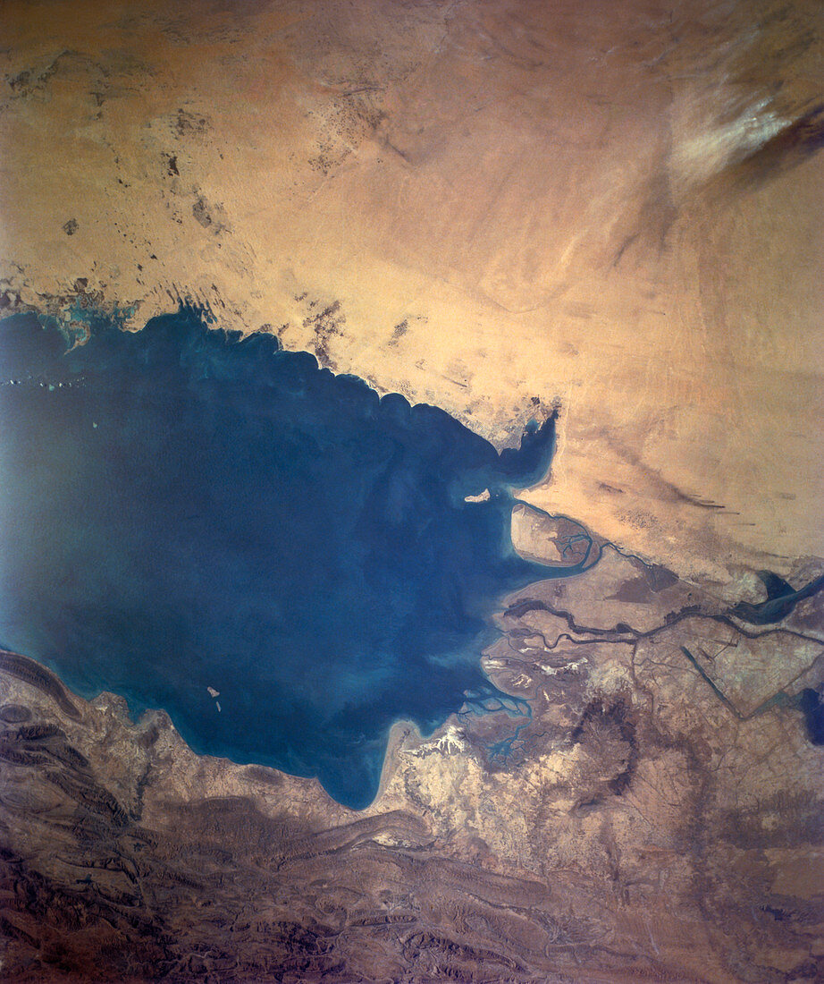
| Shuttle photograph showing the north Persian Gulf on December 4th 1988,taken from the earth- orbiting Atlantis during mission STS-27. Kuwait can be seen above the centre of the frame. Visible to the left of the Bay of Kuwait,at the top right corner of the Gulf,is Kuwait City. Iran (bottom),Iraq (upper right) and part of the Gulf Coast of Saudi Arabia (upper left) can also be seen. The Shatt-al-Arab waterway,formed by the confluence of the Tigris and Euphrates Rivers,runs into the Gulf from the right. The port of Basra in Iraq lies on this waterway,just left of the right of frame. The rugged terrain running along the bottom is the Zagros Mountains | |
| Licence : | Droits gérés |
| Crédit: | Science Photo Library / NASA |
| Taille de l’image : | 2948 px × 3516 px |
| Model Release : | Non requis |
| Property Release : | Non requis |
| Restrictions : | - |
Prix pour cette image À partir de 45 €
Produit vendu
(Calendrier, Carte postale, Carte de vœux, Impression sur textile, Packaging etc)
À partir de 45 €
Usage commercial
(Affichage, Annonce presse, Annonce TV, Carte, Digital - hors rés. sociaux, Digital - rés. sociaux etc)
À partir de 45 €
Éditorial
(Digital, Journal, Livre, Livre pratique, Magazine, Télévision etc)
À partir de 60 €
Usage non-commercial
(Digital - hors rés. sociaux, Digital - rés. sociaux etc)
À partir de 120 €