Mosaic image of the far East
Numéro d’image : 11735617
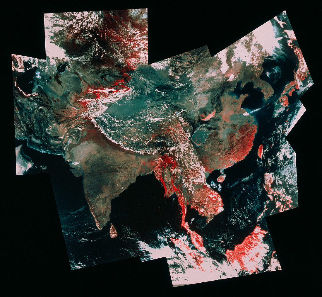
| Satellite picture of Asia formed from a mosaic of images taken by Advanced Very High Resolution Radiometer (AVHRR) equipment onboard a NOAA satellite. The picture covers an area stretching from Japan at top right,Borneo at bottom right and part of the Caspian Sea at upper left. The series of rugged folds in the centre,the Plateau of Tibet,have been thrown up by the collision of the Indian and Eurasian continental plates. The NOAA satellites follow polar orbits and provide information for weather forecasting,snow and ice monitoring and sea surface temperature measurement | |
| Licence : | Droits gérés |
| Crédit: | Science Photo Library / MDA Information Systems |
| Taille de l’image : | 3934 px × 3623 px |
| Model Release : | Non requis |
| Property Release : | Non requis |
| Restrictions : | - |
Prix pour cette image À partir de 45 €
Produit vendu
(Calendrier, Carte postale, Carte de vœux, Impression sur textile, Packaging etc)
À partir de 45 €
Usage commercial
(Affichage, Annonce presse, Annonce TV, Carte, Digital - hors rés. sociaux, Digital - rés. sociaux etc)
À partir de 45 €
Éditorial
(Digital, Journal, Livre, Livre pratique, Magazine, Télévision etc)
À partir de 60 €
Usage non-commercial
(Digital - hors rés. sociaux, Digital - rés. sociaux etc)
À partir de 120 €