Satellite image of Europe with storm
Numéro d’image : 11735604
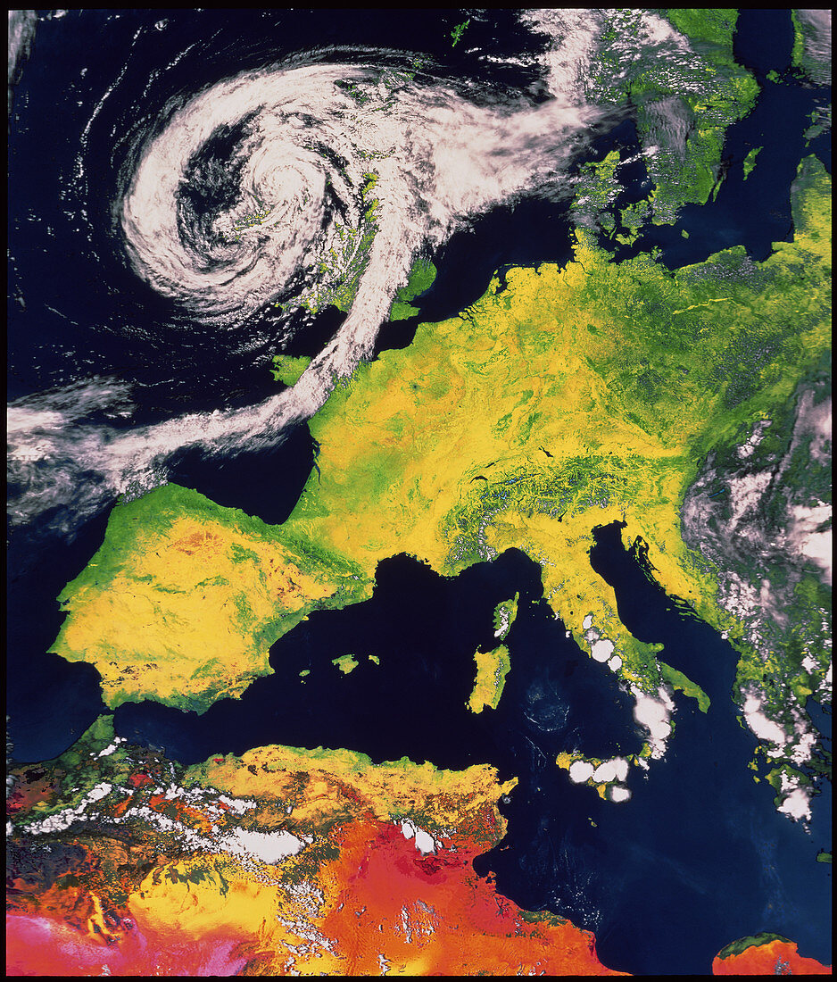
| NOAA-9 satellite image of Europe and north Africa taken on 6 August 1987. A severe storm system covers most of the British Isles. Patches of cloud are also seen over Norway,southern Italy,Sicily,Greece,south-eastern Europe,& north Africa. This false-colour image was data-processed by the DFVLR in West Germany | |
| Licence : | Droits gérés |
| Crédit: | Science Photo Library / ESA |
| Taille de l’image : | 3604 px × 4225 px |
| Model Release : | Non requis |
| Property Release : | Non requis |
| Restrictions : |
|
Prix pour cette image À partir de 45 €
Produit vendu
(Calendrier, Carte postale, Carte de vœux, Impression sur textile, Packaging etc)
À partir de 45 €
Usage commercial
(Affichage, Annonce presse, Annonce TV, Carte, Digital - hors rés. sociaux, Digital - rés. sociaux etc)
À partir de 45 €
Éditorial
(Digital, Journal, Livre, Livre pratique, Magazine, Télévision etc)
À partir de 60 €
Usage non-commercial
(Digital - hors rés. sociaux, Digital - rés. sociaux etc)
À partir de 120 €
Mots clés
- Allemagne,
- Autriche,
- Belgique,
- de l'espace,
- Espagne,
- Europe,
- europe occidentale,
- France,
- géographie,
- Gibraltar,
- Iles Baléares,
- images,
- Italie,
- météorologie,
- météorologique,
- Pays-Bas,
- photo,
- photos,
- Portugal,
- réseau pluvial,
- Royaume Uni,
- Royaume-Uni,
- Sardaigne,
- science de la terre,
- sciences,
- Slovénie,
- Suisse,
- système de tempête,
- système dépressionnaire