Coloured satellite radar image of the Earth
Numéro d’image : 11735582
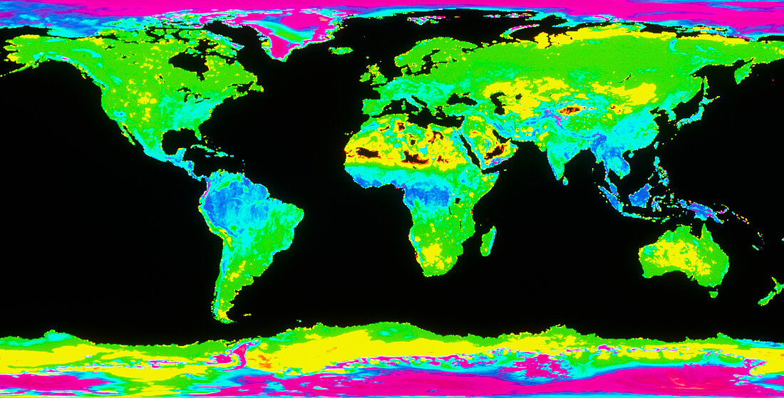
| Earth's climatic regions. Coloured satellite radar image in Mercator projection of the Earth,showing the effect of climate on the nature of the land's surface. The glacial ice sheets of the Arctic and Antarctic regions are the brightest areas. Equat- orial rainforests in South America,Africa and southeast Asia appear blue. Very dry,sandy deserts appear black,the largest such areas being the Gobi desert in Asia,the Sahara in Africa and the Empty Quarter in Saudi Arabia. Images like this can be used to check for desertification due to global warming. Image taken by the American NASA Scatterometer (NSCAT) aboard the Japanese Advanced Earth Observation Satellite (ADEOS) | |
| Licence : | Droits gérés |
| Crédit: | Science Photo Library / NASA |
| Taille de l’image : | 6511 px × 3307 px |
| Model Release : | Non requis |
| Property Release : | Non requis |
| Restrictions : | - |
Prix pour cette image À partir de 45 €
Produit vendu
(Calendrier, Carte postale, Carte de vœux, Impression sur textile, Packaging etc)
À partir de 45 €
Usage commercial
(Affichage, Annonce presse, Annonce TV, Carte, Digital - hors rés. sociaux, Digital - rés. sociaux etc)
À partir de 45 €
Éditorial
(Digital, Journal, Livre, Livre pratique, Magazine, Télévision etc)
À partir de 60 €
Usage non-commercial
(Digital - hors rés. sociaux, Digital - rés. sociaux etc)
À partir de 120 €