Map of Palestine,1588
Numéro d’image : 11735551
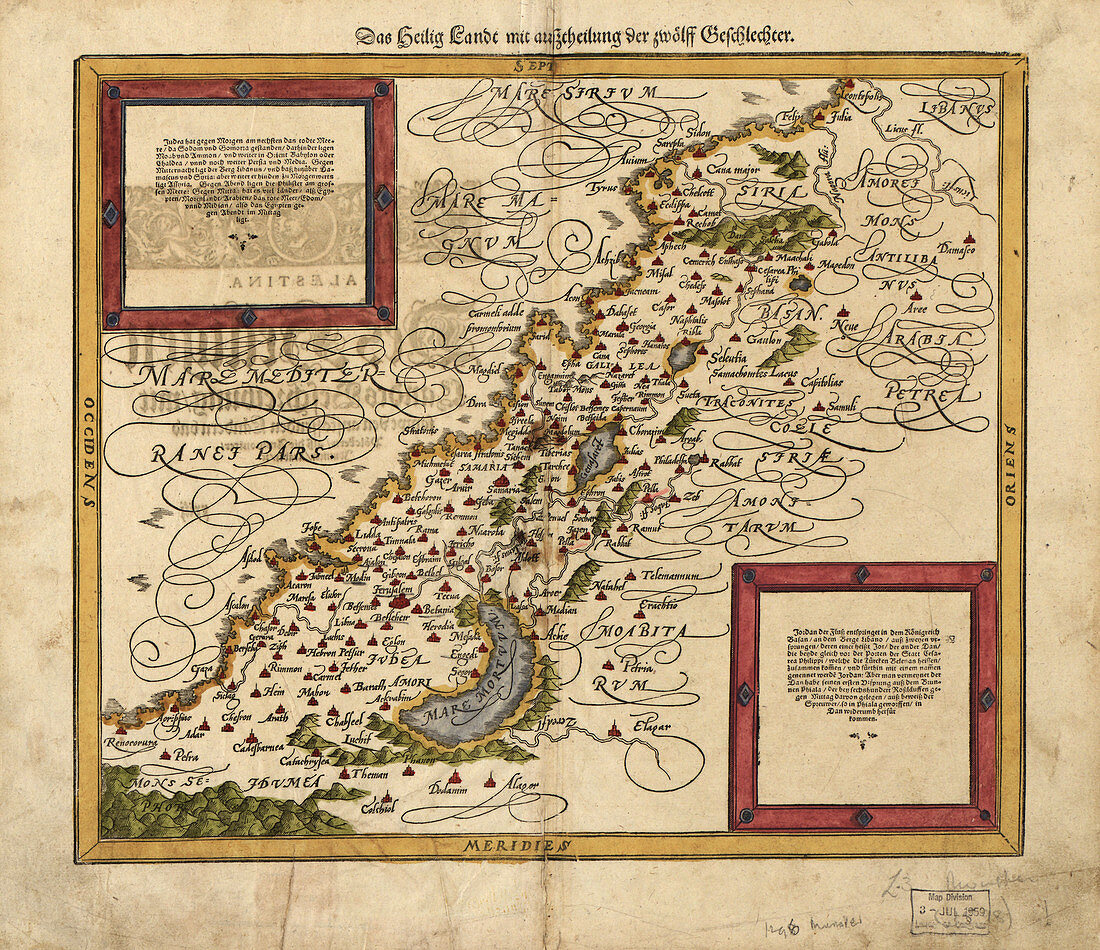
| 16th century map of Palestine. North is towards upper right. Published in 1588,this German map shows the geography of Palestine,centred on the area that later become the state of Israel. The inscriptions are in German,and the place names are in Latin. These include ancient names like Petra,Coele Syria and Judea. The Dead Sea is at lower centre,and the Mediterranean coast is at left. Numerous towns and villages are shown on the map. The map is by the German cartographer Sebastian Munster (1489-1552),and was published in Basel in a posthumous edition of his Cosmographia,the earliest German atlas | |
| Licence : | Droits gérés |
| Crédit: | Science Photo Library / LIBRARY OF CONGRESS, GEOGRAPHY AND MAP DIVISION |
| Taille de l’image : | 4967 px × 4289 px |
| Model Release : | Non requis |
| Property Release : | Non requis |
| Restrictions : | - |
Prix pour cette image À partir de 45 €
Produit vendu
(Calendrier, Carte postale, Carte de vœux, Impression sur textile, Packaging etc)
À partir de 45 €
Usage commercial
(Affichage, Annonce presse, Annonce TV, Carte, Digital - hors rés. sociaux, Digital - rés. sociaux etc)
À partir de 45 €
Éditorial
(Digital, Journal, Livre, Livre pratique, Magazine, Télévision etc)
À partir de 60 €
Usage non-commercial
(Digital - hors rés. sociaux, Digital - rés. sociaux etc)
À partir de 120 €
Mots clés
- 1500,
- 1588,
- 16ème siècle,
- âges moyens,
- allemand,
- arabe,
- carte,
- cartographie,
- cosmographia,
- cosmographie,
- époque médiévale,
- géographie,
- géographique,
- germanique,
- histoire,
- historique,
- Israël,
- Judée,
- juif,
- juive,
- médiéval,
- mer morte,
- moyen âge,
- Moyen Orient,
- Moyen-Orient,
- Palestine,
- Petra,
- vieux,
- XVIème siècle