Map of the Old World
Numéro d’image : 11735528
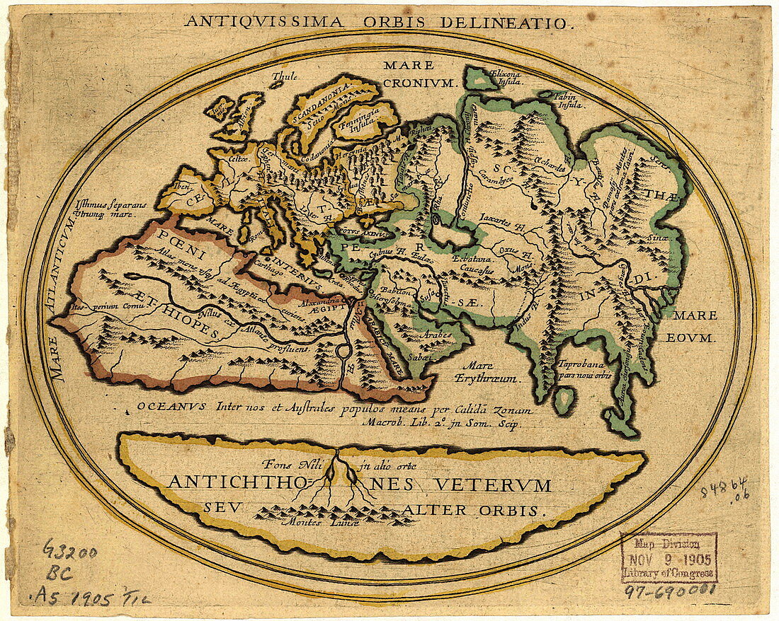
| Map of the Old World with Latin text. The title is Antiquissima Orbis Delineatio (ancient world map). The level of geographical knowledge is similar to that until the 15th century. The map shows: Europe (yellow),North Africa (red),West-Central Asia (green) and a southern area (yellow,Antichthones: antipodes). Named regions include: Mare Interius (middle sea: Mediterranean),Mare Eoum (eastern sea),Scythae (Scythia: Central Asia),Persae (Persia) and Indi (India). Forests,mountains and rivers are shown. The equator is an ocean of warm water. The Nile has a western and southern branch; the latter from the Mountains of the Moon (Montes Lunae). Catalogued: US Library of Congress (1905) | |
| Licence : | Droits gérés |
| Crédit: | Science Photo Library / LIBRARY OF CONGRESS, GEOGRAPHY AND MAP DIVISION |
| Taille de l’image : | 2468 px × 1971 px |
| Model Release : | Non requis |
| Property Release : | Non requis |
| Restrictions : | - |
Prix pour cette image À partir de 45 €
Produit vendu
(Calendrier, Carte postale, Carte de vœux, Impression sur textile, Packaging etc)
À partir de 45 €
Usage commercial
(Affichage, Annonce presse, Annonce TV, Carte, Digital - hors rés. sociaux, Digital - rés. sociaux etc)
À partir de 45 €
Éditorial
(Digital, Journal, Livre, Livre pratique, Magazine, Télévision etc)
À partir de 60 €
Usage non-commercial
(Digital - hors rés. sociaux, Digital - rés. sociaux etc)
À partir de 120 €
Mots clés
- Afrique,
- âges moyens,
- ancien,
- ANTIQUISSIMA ORBIS DELINEATIO,
- antiquité,
- Asie,
- bibliothèque du Congres,
- carte,
- cartographie,
- classique,
- continent,
- continents,
- époque médiévale,
- Eurasie,
- Europe,
- géographie,
- géographique,
- histoire,
- historique,
- illustration,
- imprécis,
- inachevé,
- incomplet,
- inexact,
- l'ancien monde,
- latin,
- le vieux monde,
- médiéval,
- monde,
- monde connu,
- moyen âge,
- oeuvre,
- schéma,
- vieux