5th century world map
Numéro d’image : 11735496
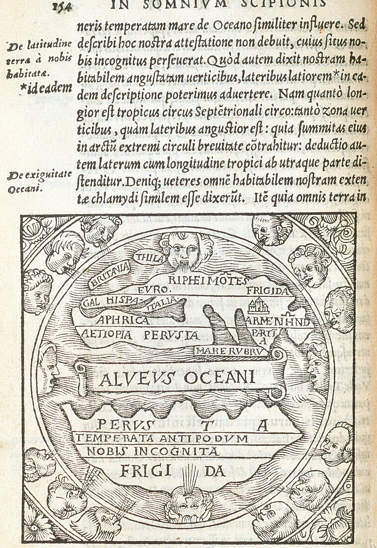
| 5th century world map,constructed by the late Roman philosopher Ambrosius Aurelius Theodosius Macrobius (395-423AD). The image is a copy of the original and was printed in 1550. It depicts a round Earth,following in the tradition of Ptolemy. The habitable world exists entirely in the northern hemisphere (lower centre) and is separated from the uninhabited southern hemisphere (bottom centre) by an ocean. The heads surrounding the map represent the winds of the world. In addition to his maps,Macrobius is known for his Commentary on the Dream of Scipio by Cicero | |
| Licence : | Droits gérés |
| Crédit: | Science Photo Library / Bernard, George |
| Taille de l’image : | 3126 px × 4535 px |
| Model Release : | Non requis |
| Property Release : | Non requis |
| Restrictions : | - |
Prix pour cette image À partir de 45 €
Produit vendu
(Calendrier, Carte postale, Carte de vœux, Impression sur textile, Packaging etc)
À partir de 45 €
Usage commercial
(Affichage, Annonce presse, Annonce TV, Carte, Digital - hors rés. sociaux, Digital - rés. sociaux etc)
À partir de 45 €
Éditorial
(Digital, Journal, Livre, Livre pratique, Magazine, Télévision etc)
À partir de 60 €
Usage non-commercial
(Digital - hors rés. sociaux, Digital - rés. sociaux etc)
À partir de 120 €
Mots clés
- 16ème,
- 16ème siècle,
- 5ème siècle,
- Afrique,
- AMBROSIUS,
- ancien,
- AURELIUS THEODOSIUS,
- carte,
- cartes,
- cartographie,
- cartographier,
- cinquième,
- copie,
- copier,
- Europe,
- hémisphère Nord,
- hémisphère sud,
- mer,
- monde,
- monochrome,
- n/b,
- noir et blanc,
- noir-et-blanc,
- océan,
- science de la terre,
- sciences,
- seizième siècle,
- terre,
- texte latin,
- Vème siècle,
- vent,
- vents,
- vieux,
- XVIème siècle