Early map of France
Numéro d’image : 11735492
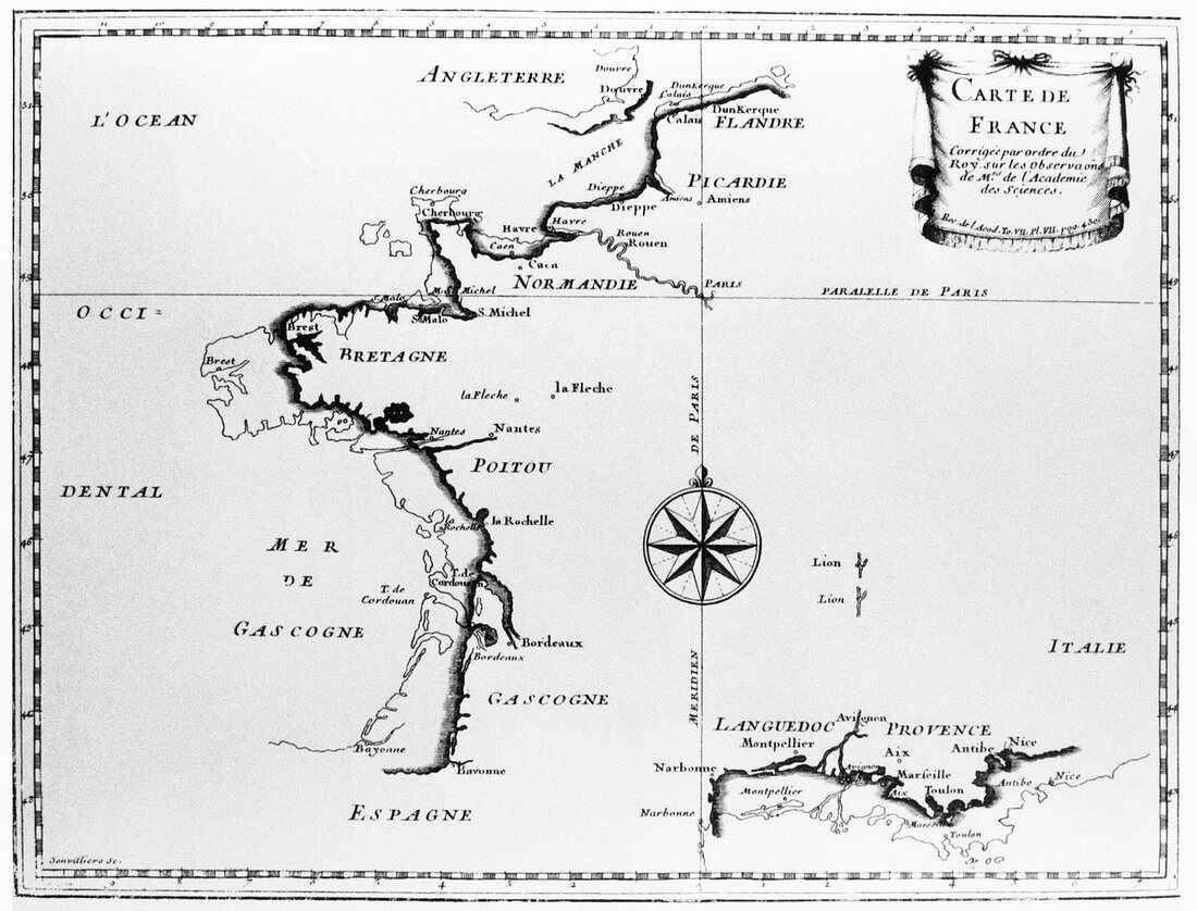
| Map of France. Historical map of France after a resurvey of the 1680s. The improved profile is seen in dark shading over the lighter shading of the previous map. The resurvey was ordered by King Louis XIV and was carried out by triangulation by the astronomers J.D. Cassini and J. Picard. The king then complained that the scientists were shrinking his territories. Image from Memoires de l'Academie Royale (1729) | |
| Licence : | Droits gérés |
| Crédit: | Science Photo Library |
| Taille de l’image : | 3358 px × 2557 px |
| Model Release : | Non requis |
| Property Release : | Non requis |
| Restrictions : | - |
Prix pour cette image À partir de 45 €
Produit vendu
(Calendrier, Carte postale, Carte de vœux, Impression sur textile, Packaging etc)
À partir de 45 €
Usage commercial
(Affichage, Annonce presse, Annonce TV, Carte, Digital - hors rés. sociaux, Digital - rés. sociaux etc)
À partir de 45 €
Éditorial
(Digital, Journal, Livre, Livre pratique, Magazine, Télévision etc)
À partir de 60 €
Usage non-commercial
(Digital - hors rés. sociaux, Digital - rés. sociaux etc)
À partir de 120 €