Historical map of Egypt and Palestine
Numéro d’image : 11735489
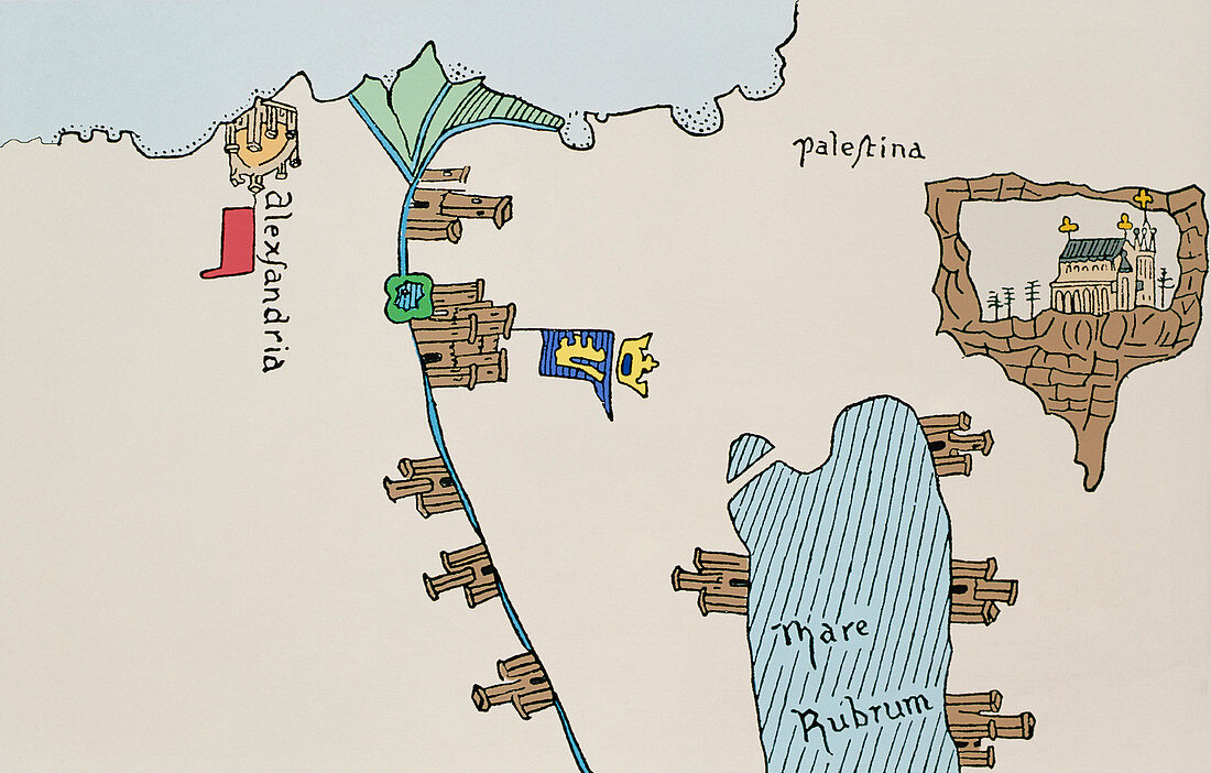
| Egypt and Palestine. Historical map showing Egypt and Palestine in the 14th century. The ancient city of Alexandria can be seen at upper left. It is here that the Alexandria lighthouse,one of the seven wonders of the world,was built. The river Nile can be seen running from upper left to lower centre. Various settlements are depicted along the Nile. To the right of the image is ancient Palestine. The Red Sea (Mare Rubrum) can be seen at lower right and at upper right is the town of Jerusalem. The Christian church shown in the image typifies Christian claims to Jerusalem at that time. Image taken from Pizzigani's 14th century map of the world | |
| Licence : | Droits gérés |
| Crédit: | Science Photo Library / Terry, Sheila |
| Taille de l’image : | 4826 px × 3078 px |
| Model Release : | Non requis |
| Property Release : | Non requis |
| Restrictions : | - |
Prix pour cette image À partir de 45 €
Produit vendu
(Calendrier, Carte postale, Carte de vœux, Impression sur textile, Packaging etc)
À partir de 45 €
Usage commercial
(Affichage, Annonce presse, Annonce TV, Carte, Digital - hors rés. sociaux, Digital - rés. sociaux etc)
À partir de 45 €
Éditorial
(Digital, Journal, Livre, Livre pratique, Magazine, Télévision etc)
À partir de 60 €
Usage non-commercial
(Digital - hors rés. sociaux, Digital - rés. sociaux etc)
À partir de 120 €