Earth
Numéro d’image : 11735137
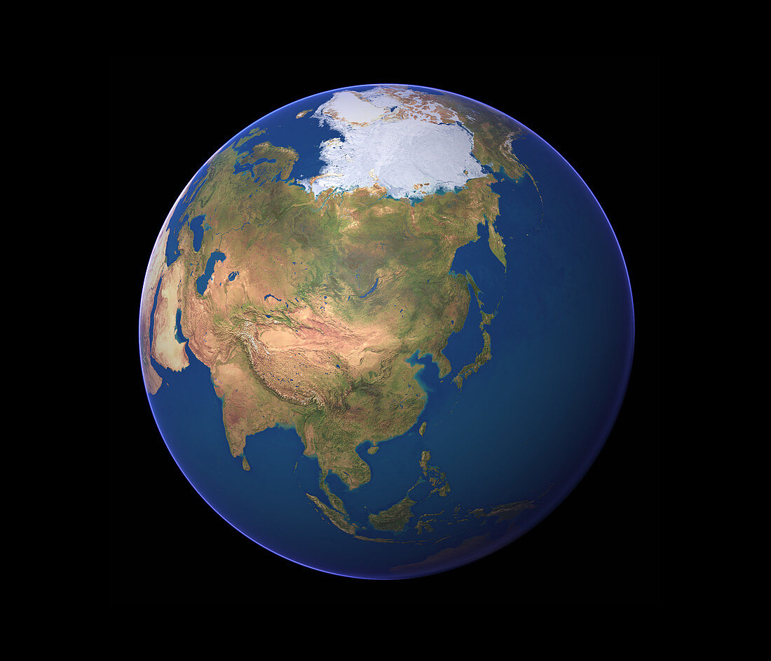
| Earth. Satellite image of the Earth,centred on eastern Asia. North is at top. Water is blue,vegetation is green,arid areas are brown and snow and ice are white. The land mass of Eurasia,the Earth's largest continent,dominates the image. It consists of Asia and Europe (upper left),and is circled by the Arctic (upper centre),Pacific (top to bottom right) and Indian (lower left) oceans | |
| Licence : | Droits gérés |
| Crédit: | Science Photo Library / Planetary Visions |
| Taille de l’image : | 3500 px × 3000 px |
| Model Release : | Non requis |
| Property Release : | Non requis |
| Restrictions : | - |
Prix pour cette image À partir de 45 €
Produit vendu
(Calendrier, Carte postale, Carte de vœux, Impression sur textile, Packaging etc)
À partir de 45 €
Usage commercial
(Affichage, Annonce presse, Annonce TV, Carte, Digital - hors rés. sociaux, Digital - rés. sociaux etc)
À partir de 45 €
Éditorial
(Digital, Journal, Livre, Livre pratique, Magazine, Télévision etc)
À partir de 60 €
Usage non-commercial
(Digital - hors rés. sociaux, Digital - rés. sociaux etc)
À partir de 120 €
Mots clés
- Arctique,
- Asie,
- cercle,
- circulaire,
- continent,
- continents,
- de l'espace,
- désert,
- eau,
- Eurasie,
- Europe,
- géographie,
- géographique,
- glace,
- globe,
- hémisphère,
- horizontal,
- image satellite,
- imagerie satellitaire,
- imagerie satellite,
- images,
- indien,
- mer,
- mers,
- monde,
- neige,
- observation,
- océan,
- océans,
- pacifique,
- photo,
- photos,
- planétaire,
- planète,
- Pôle Nord,
- rond,
- science de la terre,
- sciences,
- terre,
- végétation