GOES satellite image of South America
Numéro d’image : 11735087
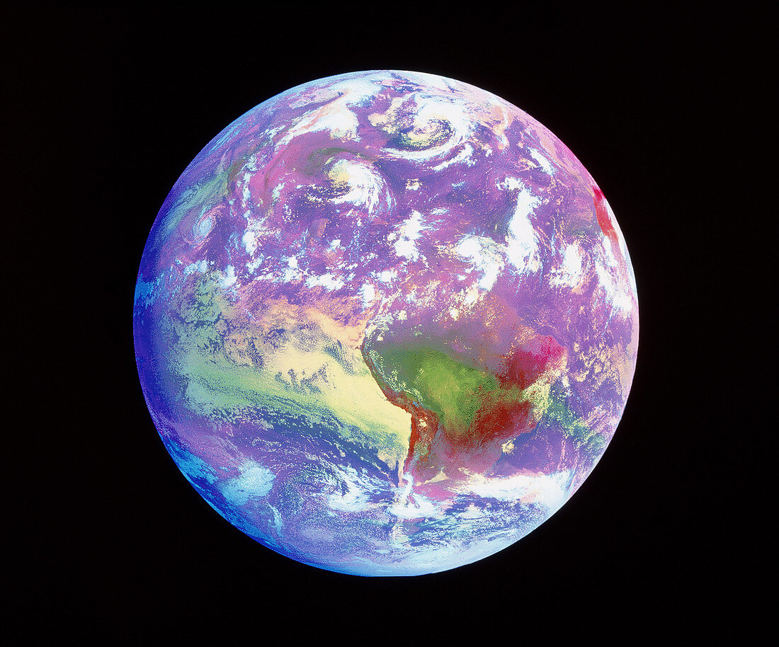
| South America. Coloured combined visible and infrared GOES satellite image of South America and storms in the Atlantic Ocean. The continent of South America is seen at lower centre. Above it is the North Atlantic Ocean,showing several spiralling storm systems (white). North America is at upper left. To the left of South America is the Pacific Ocean. The GOES satellites are weather satellites which track the movements of weather systems,and provide data for accurate forecasts. This image was processed from data from GOES satellites taken on 25th August 1995,and 14:45 GMT | |
| Licence : | Droits gérés |
| Crédit: | Science Photo Library / NASA's Goddard Space Flight Center |
| Taille de l’image : | 4135 px × 3436 px |
| Model Release : | Non requis |
| Property Release : | Non requis |
| Restrictions : | - |
Prix pour cette image À partir de 45 €
Produit vendu
(Calendrier, Carte postale, Carte de vœux, Impression sur textile, Packaging etc)
À partir de 45 €
Usage commercial
(Affichage, Annonce presse, Annonce TV, Carte, Digital - hors rés. sociaux, Digital - rés. sociaux etc)
À partir de 45 €
Éditorial
(Digital, Journal, Livre, Livre pratique, Magazine, Télévision etc)
À partir de 60 €
Usage non-commercial
(Digital - hors rés. sociaux, Digital - rés. sociaux etc)
À partir de 120 €