Meteosat satellite image of the Earth
Numéro d’image : 11735063
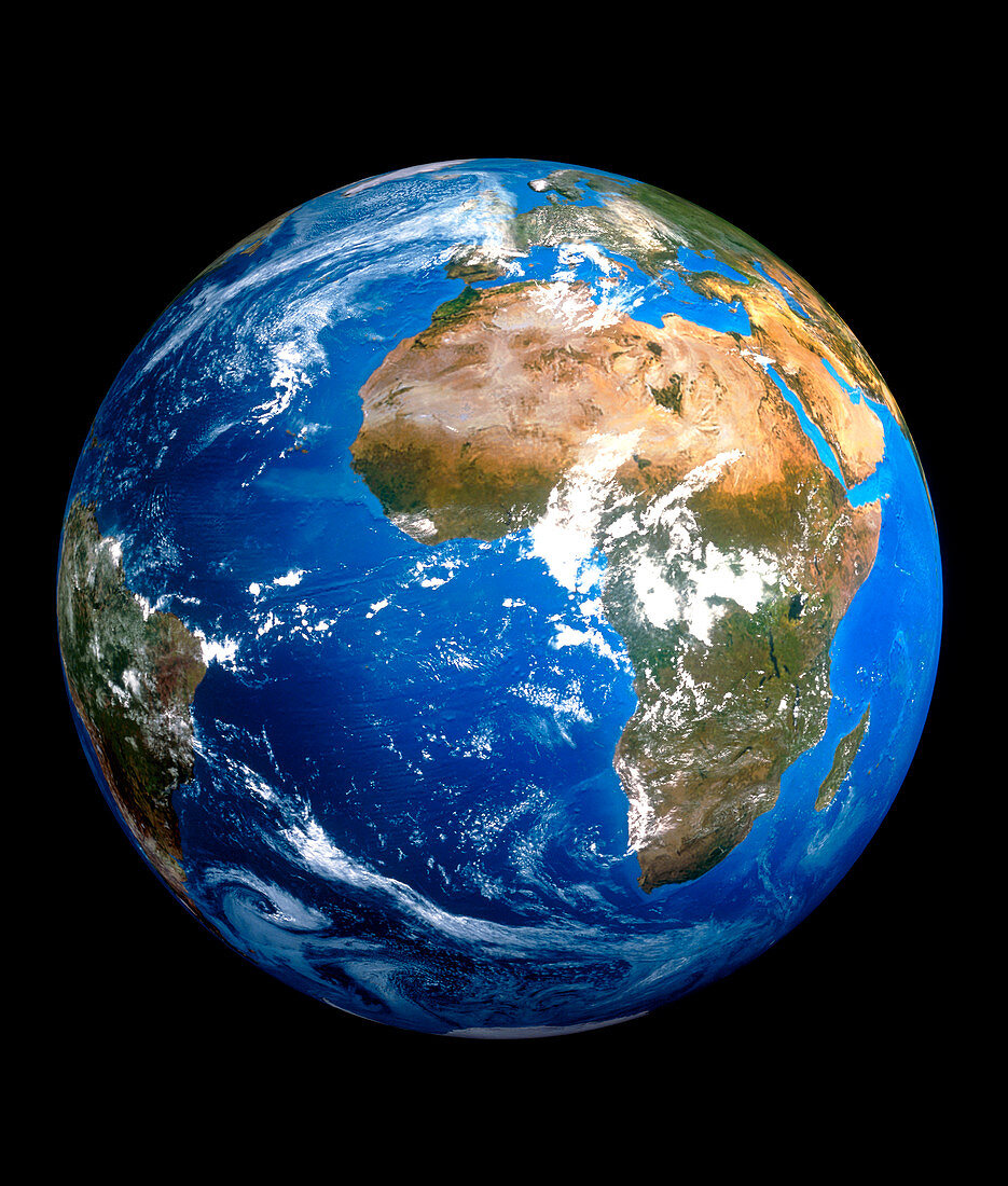
| Earth from space. Satellite image of the Earth,centred on Africa. North is at top. The colours approximate to true colours. Desert and arid regions are light brown,forested and vegetated areas are green,and oceans blue. Europe is at upper centre,and part of South America is at left. Many weather systems,as revealed by white clouds,can be seen. The polar ice caps are at top and bottom. Image taken by a European Meteosat weather satellite in geostationary orbit 35,790 km above the equator | |
| Licence : | Droits gérés |
| Crédit: | Science Photo Library / ESA |
| Taille de l’image : | 4017 px × 4724 px |
| Model Release : | Non requis |
| Property Release : | Non requis |
| Restrictions : |
|
Prix pour cette image À partir de 45 €
Produit vendu
(Calendrier, Carte postale, Carte de vœux, Impression sur textile, Packaging etc)
À partir de 45 €
Usage commercial
(Affichage, Annonce presse, Annonce TV, Carte, Digital - hors rés. sociaux, Digital - rés. sociaux etc)
À partir de 45 €
Éditorial
(Digital, Journal, Livre, Livre pratique, Magazine, Télévision etc)
À partir de 60 €
Usage non-commercial
(Digital - hors rés. sociaux, Digital - rés. sociaux etc)
À partir de 120 €