Whole earth
Numéro d’image : 11735040
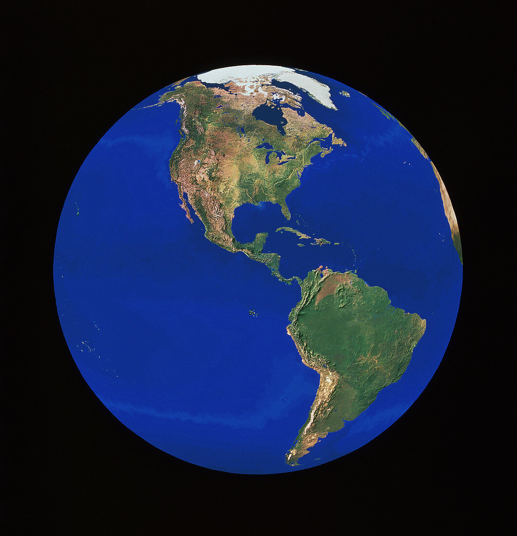
| Whole Earth centred on Central America,showing the continents of North and South America. This image is a combination of hundreds of images acquired by NOAA weather satellites from orbits some 820 km above Earth. Each frame has a resolution of 1 kilometre. The mosaic of frames was then combined with a high- resolution digital elevation model. To emphasize relief features,the elevation model was stretched by a factor of two,and simulated solar illumination added | |
| Licence : | Droits gérés |
| Crédit: | Science Photo Library / Worldsat International / Knighton, J. |
| Taille de l’image : | 3712 px × 3847 px |
| Model Release : | Non requis |
| Property Release : | Non requis |
| Restrictions : |
|
Prix pour cette image À partir de 45 €
Produit vendu
(Calendrier, Carte postale, Carte de vœux, Impression sur textile, Packaging etc)
À partir de 45 €
Usage commercial
(Affichage, Annonce presse, Annonce TV, Carte, Digital - hors rés. sociaux, Digital - rés. sociaux etc)
À partir de 45 €
Éditorial
(Digital, Journal, Livre, Livre pratique, Magazine, Télévision etc)
À partir de 60 €
Usage non-commercial
(Digital - hors rés. sociaux, Digital - rés. sociaux etc)
À partir de 120 €
Mots clés
- Amérique,
- Amérique Centrale,
- Amérique du Nord,
- Amérique du Sud,
- carte satellite,
- continent,
- de l'espace,
- entiereté,
- géographie,
- globalité,
- globe,
- image de Noaa,
- images,
- images du satellite Noaa,
- monde,
- photo,
- photo satellite,
- photos,
- planète terre,
- rond,
- science de la terre,
- sciences,
- terre,
- terre entière,
- totalité