Whole earth
Numéro d’image : 11735038
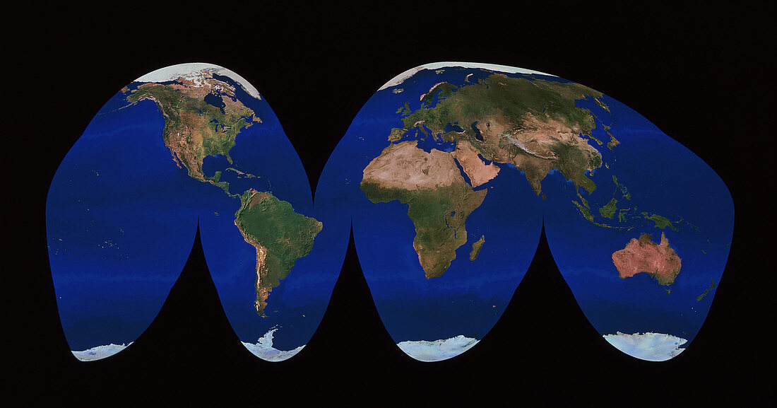
| Whole Earth flattened using the Goode Homolosine projection. This image is a combination of hundreds of images acquired by NOAA weather satellites from orbits some 820 km above Earth. Each frame has a resolution of 1 kilometre. The mosaic of frames was then combined with a high-resolution digital elevation model. To emphasize relief features,the elevation model was stretched by a factor of two,and simulated solar illumination added. Arctic and Antarctic ice caps are white (at top and bottom).<br>Restrictions: | |
| Licence : | Droits gérés |
| Crédit: | Science Photo Library / Worldsat International / Knighton, J. |
| Taille de l’image : | 5212 px × 2734 px |
| Model Release : | Non requis |
| Property Release : | Non requis |
| Restrictions : |
|
Prix pour cette image À partir de 45 €
Produit vendu
(Calendrier, Carte postale, Carte de vœux, Impression sur textile, Packaging etc)
À partir de 45 €
Usage commercial
(Affichage, Annonce presse, Annonce TV, Carte, Digital - hors rés. sociaux, Digital - rés. sociaux etc)
À partir de 45 €
Éditorial
(Digital, Journal, Livre, Livre pratique, Magazine, Télévision etc)
À partir de 60 €
Usage non-commercial
(Digital - hors rés. sociaux, Digital - rés. sociaux etc)
À partir de 120 €