Meteosat view of the whole Earth
Numéro d’image : 11735030
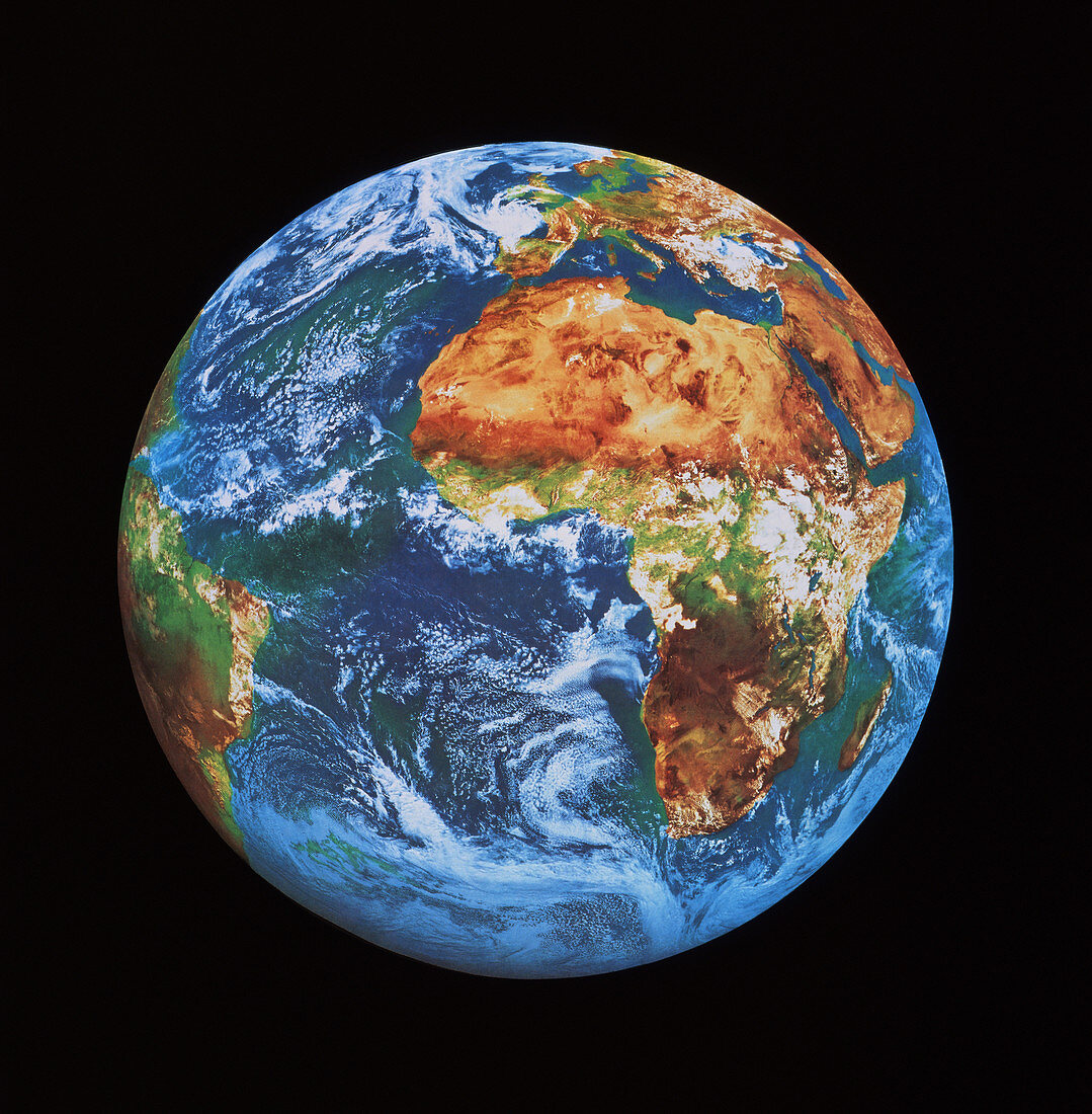
| Whole Earth. Coloured satellite image of the Earth centred on Africa. Tones approximate to true colours. The yellow expanse of the Sahara Desert in North Africa is visible,with the green rain- forest belt of equatorial Africa covered by cloud systems. Europe is at top frame; South America at far left. Swirling frontal cloud systems occur both in the north and south Atlantic Ocean. Image taken by a Meteosat weather satellite on 6 July 1991. Meteosat is operated on behalf of its owners Eumetsat by the European Space Agency (ESA) | |
| Licence : | Droits gérés |
| Crédit: | Science Photo Library / ESA |
| Taille de l’image : | 3742 px × 3814 px |
| Model Release : | Non requis |
| Property Release : | Non requis |
| Restrictions : |
|
Prix pour cette image À partir de 45 €
Produit vendu
(Calendrier, Carte postale, Carte de vœux, Impression sur textile, Packaging etc)
À partir de 45 €
Usage commercial
(Affichage, Annonce presse, Annonce TV, Carte, Digital - hors rés. sociaux, Digital - rés. sociaux etc)
À partir de 45 €
Éditorial
(Digital, Journal, Livre, Livre pratique, Magazine, Télévision etc)
À partir de 60 €
Usage non-commercial
(Digital - hors rés. sociaux, Digital - rés. sociaux etc)
À partir de 120 €