Earth from space,with Africa
Numéro d’image : 11735003
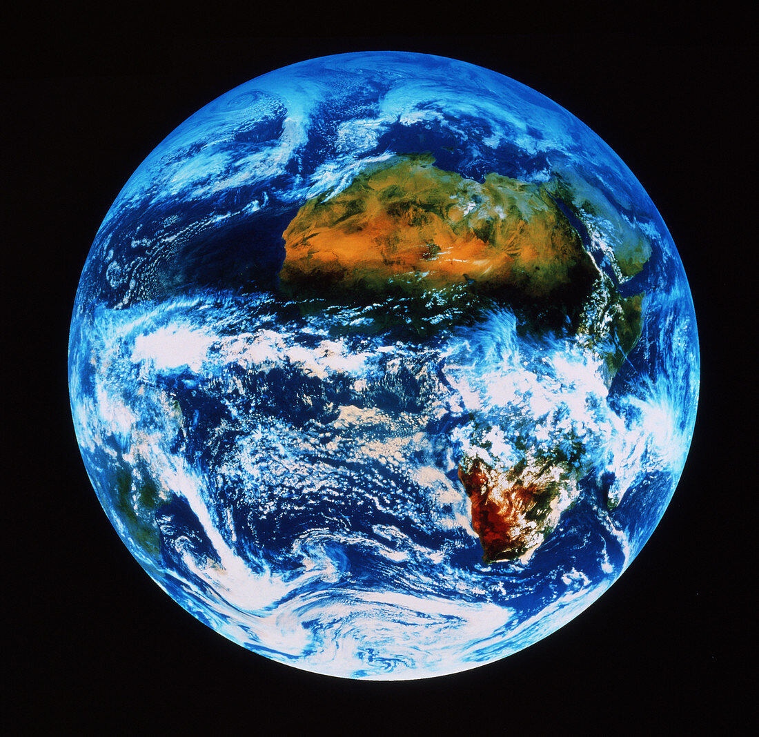
| Satellite view of the Earth. Coloured satellite image of the Earth,showing Africa. Parts of central Africa are obscured by extensive thunderstorm systems. The Sahara Desert and the Middle East are free of cloud. South Africa may also be seen,just lower right of centre. Part of South America is just visible at lower left. The clouds are differentiated by colour addition; high level clouds are a bluish white whilst lower level clouds have a pale orange/brown tint. Land colours approximate to natural tones. The data for this image were gathered by a Meteosat weather satellite | |
| Licence : | Droits gérés |
| Crédit: | Science Photo Library / Geospace |
| Taille de l’image : | 3830 px × 3719 px |
| Model Release : | Non requis |
| Property Release : | Non requis |
| Restrictions : | - |
Prix pour cette image À partir de 45 €
Produit vendu
(Calendrier, Carte postale, Carte de vœux, Impression sur textile, Packaging etc)
À partir de 45 €
Usage commercial
(Affichage, Annonce presse, Annonce TV, Carte, Digital - hors rés. sociaux, Digital - rés. sociaux etc)
À partir de 45 €
Éditorial
(Digital, Journal, Livre, Livre pratique, Magazine, Télévision etc)
À partir de 60 €
Usage non-commercial
(Digital - hors rés. sociaux, Digital - rés. sociaux etc)
À partir de 120 €
Mots clés
- Afrique,
- Afrique du Sud,
- climat,
- de l'espace,
- désert du Sahara,
- entiereté,
- géographie,
- globalité,
- image satellite,
- imagerie satellitaire,
- imagerie satellite,
- images,
- météorologie,
- météorologique,
- météosat,
- modèle météo,
- modèle météorologique,
- nuages,
- photo,
- photos,
- science de la terre,
- sciences,
- terre,
- terre entière,
- totalité