Southern Hemisphere,GeoSphere and bathymetry
Numéro d’image : 11734993
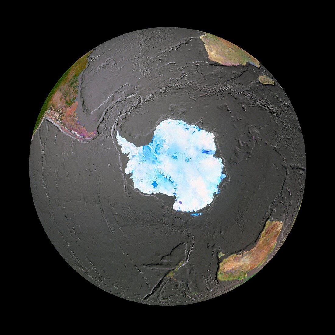
| GeoSphere satellite mosaic image of the whole Earth showing bathymetry centered on the South Pole. Land cover information from satellite images is merged with an ocean topography model. Notable ocean features include the large,curved Scotia Ridge (upper left),the South-West Indian Ridge (upper right) and the deep Kermadec/Tonga Trench (bottom centre). Only the permanent ice cover of Antarctica is shown here. Near upper left is South America,with its large coastal trench (Peru/ Chile) on the lower side. This is the site of a destructive plate margin,also responsible for the Andes mountain range | |
| Licence : | Droits gérés |
| Crédit: | Science Photo Library / GEOSPHERE PROJECT, SANTA MONICA / COPYRIGHT TOM VAN SANT |
| Taille de l’image : | 4228 px × 4228 px |
| Model Release : | Non requis |
| Property Release : | Non requis |
| Restrictions : |
|
Prix pour cette image À partir de 45 €
Produit vendu
(Calendrier, Carte postale, Carte de vœux, Impression sur textile, Packaging etc)
À partir de 45 €
Usage commercial
(Affichage, Annonce presse, Annonce TV, Carte, Digital - hors rés. sociaux, Digital - rés. sociaux etc)
À partir de 45 €
Éditorial
(Digital, Journal, Livre, Livre pratique, Magazine, Télévision etc)
À partir de 60 €
Usage non-commercial
(Digital - hors rés. sociaux, Digital - rés. sociaux etc)
À partir de 120 €