Atlantic Ocean GeoSphere with bathymetry
Numéro d’image : 11734992
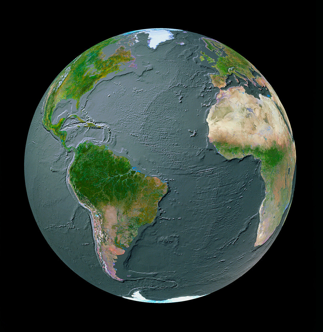
| GeoSphere mosaic satellite image of the whole Earth showing bathymetry of the Atlantic Ocean. Land cover information from satellite images is merged with an ocean topography model. The obvious ocean-floor feature is the Mid-Atlantic Ridge,a tectonic spreading fault that appears like a scar along the length of the ocean. Also clear are the continental shelves of Europe (top right),North America (top left) and South America's east coast (bottom left). On the west coast of the Americas is a destructive plate margin,responsible for the Andes and Rocky mountain ranges | |
| Licence : | Droits gérés |
| Crédit: | Science Photo Library / GEOSPHERE PROJECT, SANTA MONICA / COPYRIGHT TOM VAN SANT |
| Taille de l’image : | 4287 px × 4401 px |
| Model Release : | Non requis |
| Property Release : | Non requis |
| Restrictions : |
|
Prix pour cette image À partir de 45 €
Produit vendu
(Calendrier, Carte postale, Carte de vœux, Impression sur textile, Packaging etc)
À partir de 45 €
Usage commercial
(Affichage, Annonce presse, Annonce TV, Carte, Digital - hors rés. sociaux, Digital - rés. sociaux etc)
À partir de 45 €
Éditorial
(Digital, Journal, Livre, Livre pratique, Magazine, Télévision etc)
À partir de 60 €
Usage non-commercial
(Digital - hors rés. sociaux, Digital - rés. sociaux etc)
À partir de 120 €