Whole earth
Numéro d’image : 11734977
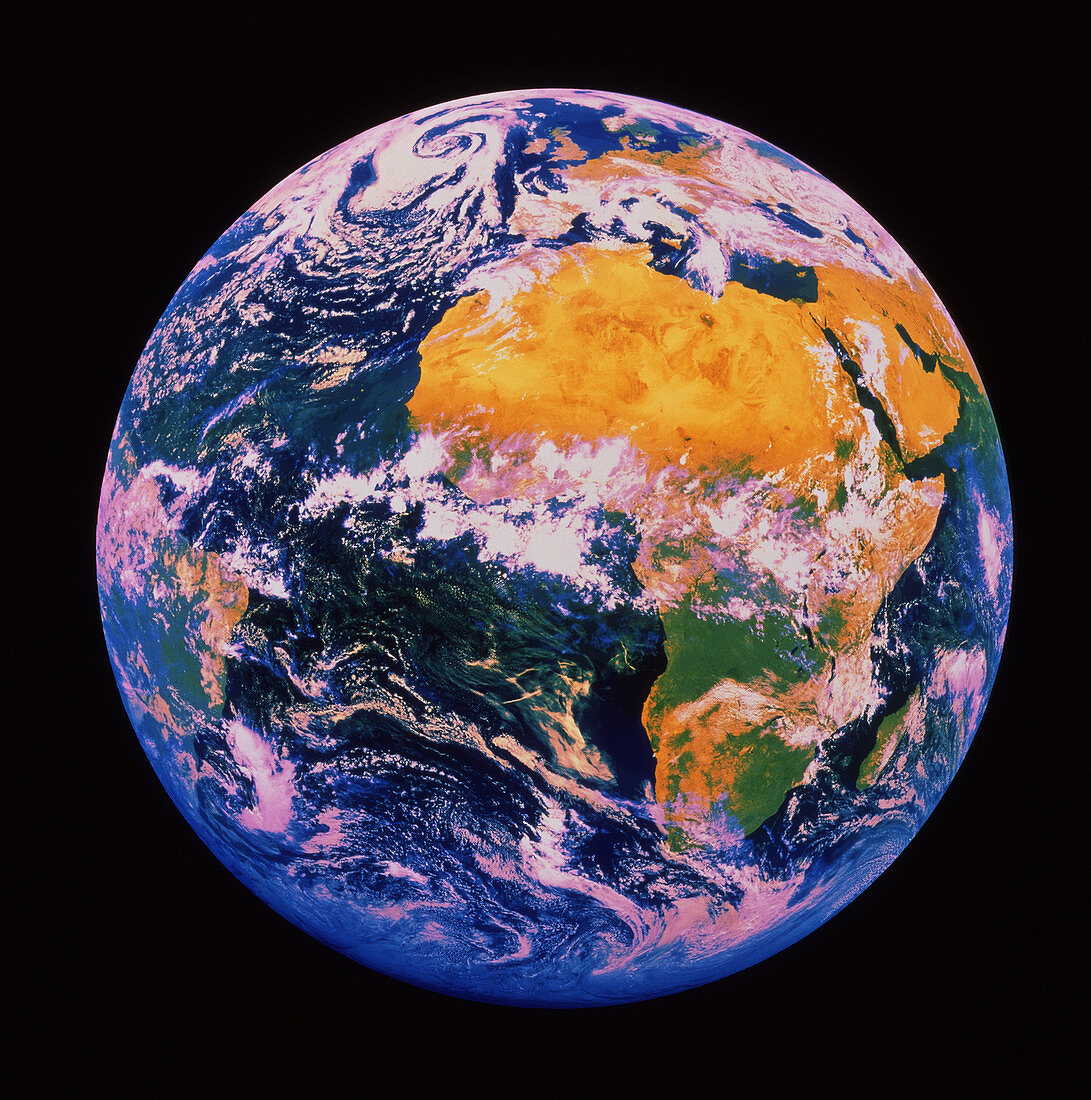
| The whole Earth seen from space. This false-colour image is centered on the equator at the prime meridian (0 degrees). The continent of Africa dominates the image,with the yellow expanse of the Sahara Desert clearly visible. Most of the African rain forest belt (green) is covered by cloud systems. Europe is at the top of the frame,with the UK clear of cloud. A swirling frontal cloud system is seen toward top left. Part of South America is seen toward bottom left. Dense clouds are shown as white,thinner cloud cover shown as pink. The data for this image were gathered by the Meteosat 4 weather satellite in geostationary orbit in early 1990 | |
| Licence : | Droits gérés |
| Crédit: | Science Photo Library / NRSC LTD |
| Taille de l’image : | 3762 px × 3792 px |
| Model Release : | Non requis |
| Property Release : | Non requis |
| Restrictions : | - |
Prix pour cette image À partir de 45 €
Produit vendu
(Calendrier, Carte postale, Carte de vœux, Impression sur textile, Packaging etc)
À partir de 45 €
Usage commercial
(Affichage, Annonce presse, Annonce TV, Carte, Digital - hors rés. sociaux, Digital - rés. sociaux etc)
À partir de 45 €
Éditorial
(Digital, Journal, Livre, Livre pratique, Magazine, Télévision etc)
À partir de 60 €
Usage non-commercial
(Digital - hors rés. sociaux, Digital - rés. sociaux etc)
À partir de 120 €