Satellite image centred on Indian Ocean
Numéro d’image : 11734975
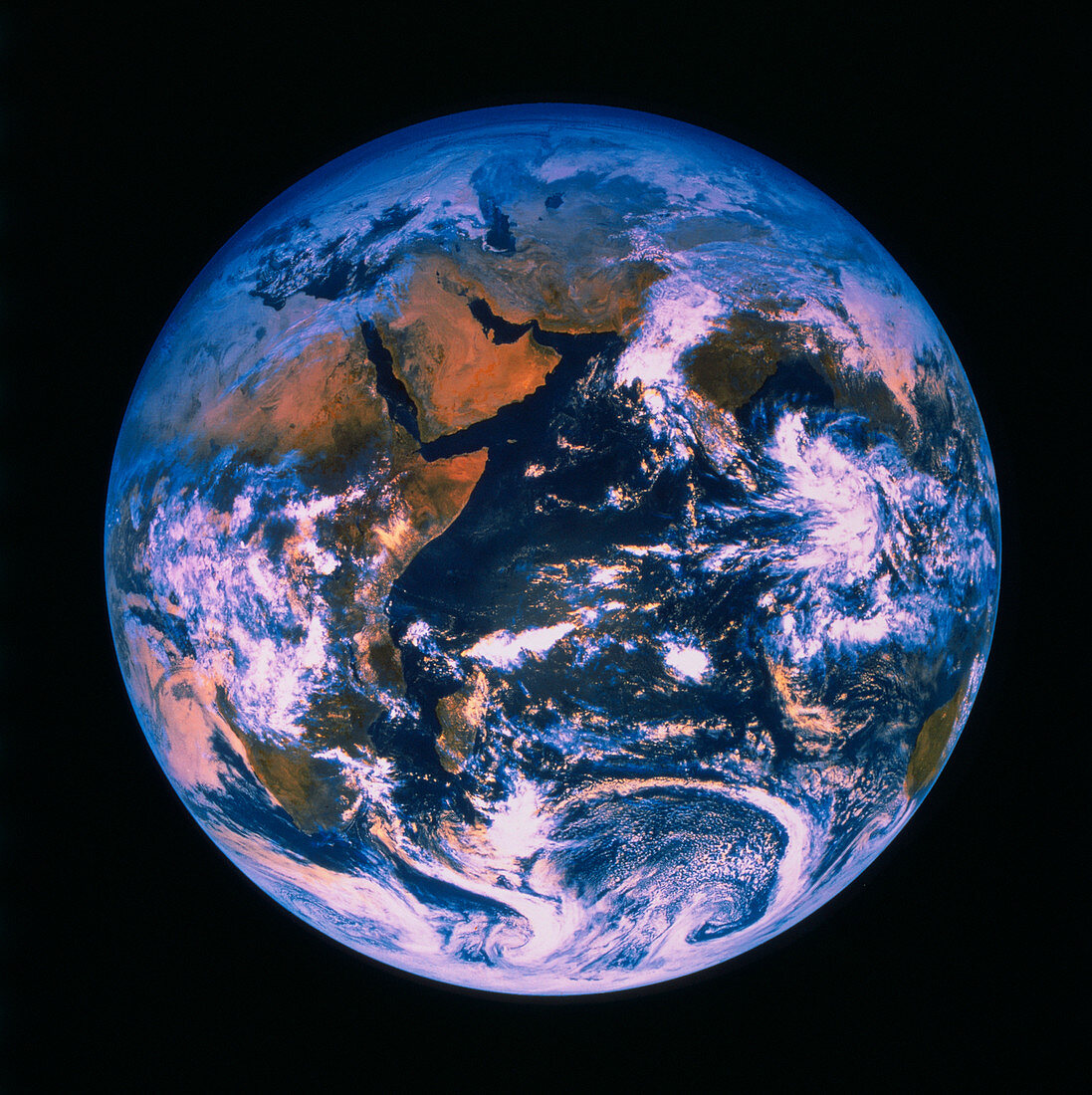
| False-colour satellite image of the Earth,centered on the Indian Ocean. The outline of the whole east coast of Africa may be seen,with the island of Madagascar lower left of centre. The Arabian Peninsula is particularly clear,as is the adjacent Iran/Afghanistan region. Part of India is seen between the clouds upper right of centre. At the lower right edge is the west coast of Australia. Note the turbulent mixing of air near Antarctica at bottom shown by the swirling clouds. This shows the breakdown of the circumpolar vortex winds which confine air over the south pole during the southern winter and spring. This image was made by a GOES satellite in November 1983 | |
| Licence : | Droits gérés |
| Crédit: | Science Photo Library / NRSC LTD |
| Taille de l’image : | 3765 px × 3775 px |
| Model Release : | Non requis |
| Property Release : | Non requis |
| Restrictions : | - |
Prix pour cette image À partir de 45 €
Produit vendu
(Calendrier, Carte postale, Carte de vœux, Impression sur textile, Packaging etc)
À partir de 45 €
Usage commercial
(Affichage, Annonce presse, Annonce TV, Carte, Digital - hors rés. sociaux, Digital - rés. sociaux etc)
À partir de 45 €
Éditorial
(Digital, Journal, Livre, Livre pratique, Magazine, Télévision etc)
À partir de 60 €
Usage non-commercial
(Digital - hors rés. sociaux, Digital - rés. sociaux etc)
À partir de 120 €