Earth
Numéro d’image : 11734973
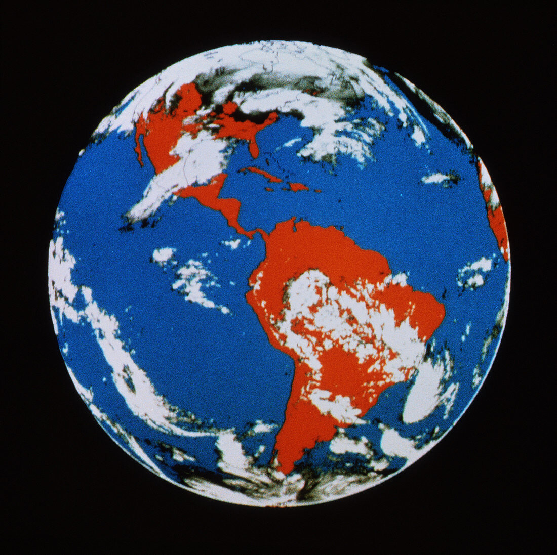
| False-colour view of the whole Earth,made by an unidentified Geostationary Operational Environmental Satellite (GOES) and centred on the Americas. The image has been colour coded so that water appears as blue,land as red and cloud as white. The GOES series was introduced in 1975. Two of these geostationary satellites are kept on station to monitor weather systems on both coasts of the USA. This allows early identification of hurricanes and other storms. GOES uses a visible/infrared scanning sensor to collect data,later models also having an atmospheric sounder for making humidity measurements. The next generation of GOES will be introduced in 1992 | |
| Licence : | Droits gérés |
| Crédit: | Science Photo Library / WSI |
| Taille de l’image : | 3807 px × 3797 px |
| Model Release : | Non requis |
| Property Release : | Non requis |
| Restrictions : | - |
Prix pour cette image À partir de 45 €
Produit vendu
(Calendrier, Carte postale, Carte de vœux, Impression sur textile, Packaging etc)
À partir de 45 €
Usage commercial
(Affichage, Annonce presse, Annonce TV, Carte, Digital - hors rés. sociaux, Digital - rés. sociaux etc)
À partir de 45 €
Éditorial
(Digital, Journal, Livre, Livre pratique, Magazine, Télévision etc)
À partir de 60 €
Usage non-commercial
(Digital - hors rés. sociaux, Digital - rés. sociaux etc)
À partir de 120 €
Mots clés
- Amérique du Sud,
- Amériques,
- cartographie,
- de l'espace,
- image satellite,
- imagerie satellitaire,
- imagerie satellite,
- images,
- images du satellite environnemental opérationel géostationnaire,
- images GOES,
- météo,
- météorologie,
- météorologique,
- nuage,
- photo,
- photos,
- satellite,
- science de la terre,
- sciences,
- terre,
- terre entière