Map of wind over Pacific Ocean
Numéro d’image : 11734943
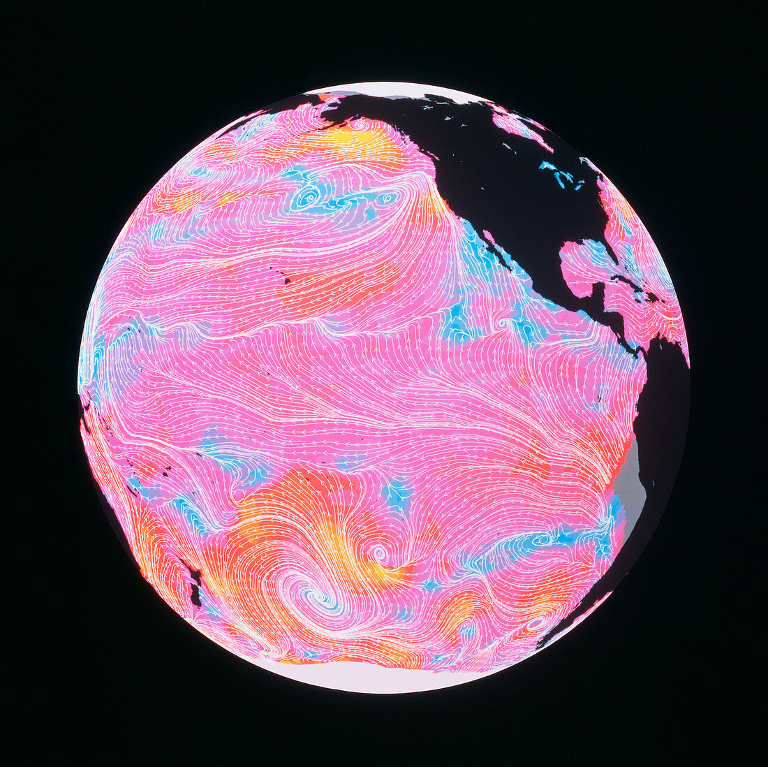
| Satellite map of wind speed and direction over the Pacific Ocean. The arrows represent wind direction & the colours wind speed. Blue indicates wind speeds of 0-14 kilometres per hour (kph),purple & pink speeds of 15-43 kph,red & orange speeds of 44-72 kph. Note the high wind speeds near storms in the South Pacific and south of Alaska. The image was derived from data obtained on 14 September 1978 by the scatterometer instrument on NASA's Seasat satellite; the data was processed in 1989 at NASA's Jet Propulsion Laboratory (JPL) in Pasadena,California | |
| Licence : | Droits gérés |
| Crédit: | Science Photo Library / NASA |
| Taille de l’image : | 3782 px × 3776 px |
| Model Release : | Non requis |
| Property Release : | Non requis |
| Restrictions : | - |
Prix pour cette image À partir de 45 €
Produit vendu
(Calendrier, Carte postale, Carte de vœux, Impression sur textile, Packaging etc)
À partir de 45 €
Usage commercial
(Affichage, Annonce presse, Annonce TV, Carte, Digital - hors rés. sociaux, Digital - rés. sociaux etc)
À partir de 45 €
Éditorial
(Digital, Journal, Livre, Livre pratique, Magazine, Télévision etc)
À partir de 60 €
Usage non-commercial
(Digital - hors rés. sociaux, Digital - rés. sociaux etc)
À partir de 120 €