Whole earth in Robinson projection
Numéro d’image : 11734935
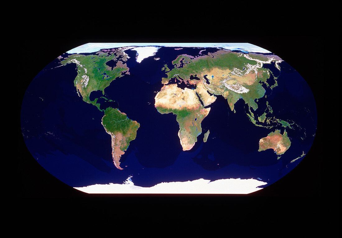
| Satellite image of the Earth in the Robinson projection. The picture is a cloud-free composite created from thousands of separate images recorded by the Tiros-N series of meteorological satellites of NOAA. Each Tiros image was selected to best show the characteristics of a particular region. The chosen images were compiled into a vast database using a supercomputer which then generated this composite picture. The picture is one of the results of the GeoSphere Project,created by Tom Van Sant in Santa Monica,California | |
| Licence : | Droits gérés |
| Crédit: | Science Photo Library / GEOSPHERE PROJECT, SANTA MONICA / COPYRIGHT TOM VAN SANT |
| Taille de l’image : | 4504 px × 3132 px |
| Model Release : | Non requis |
| Property Release : | Non requis |
| Restrictions : |
|
Prix pour cette image À partir de 45 €
Produit vendu
(Calendrier, Carte postale, Carte de vœux, Impression sur textile, Packaging etc)
À partir de 45 €
Usage commercial
(Affichage, Annonce presse, Annonce TV, Carte, Digital - hors rés. sociaux, Digital - rés. sociaux etc)
À partir de 45 €
Éditorial
(Digital, Journal, Livre, Livre pratique, Magazine, Télévision etc)
À partir de 60 €
Usage non-commercial
(Digital - hors rés. sociaux, Digital - rés. sociaux etc)
À partir de 120 €