Earth
Numéro d’image : 11734921
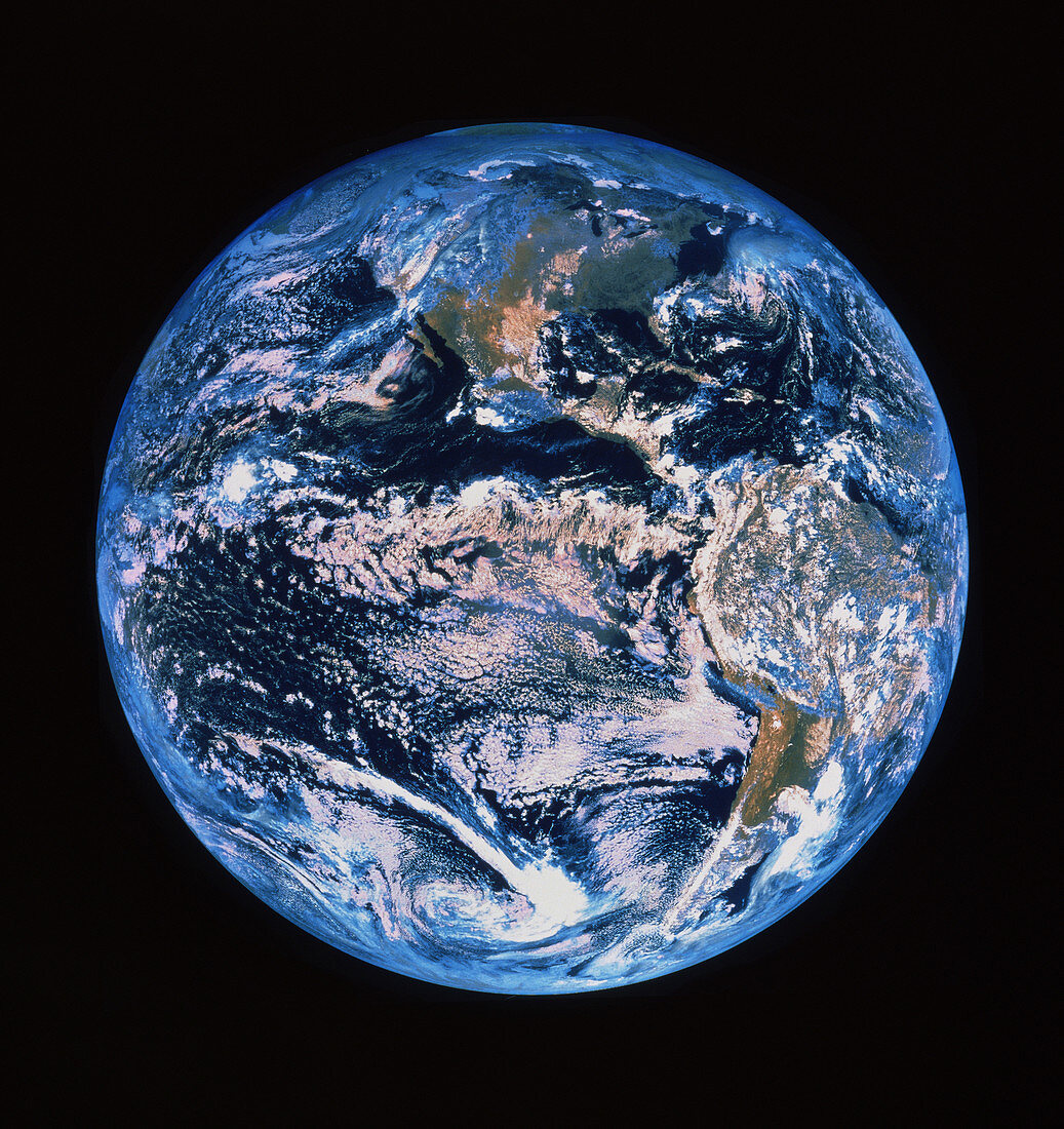
| Satellite image of the whole Earth showing North and South America and the Pacific Ocean. The image was obtained by one of the Geostationary Operational Environmental Satellites (GOES),which are operated by the US National Oceanic and Atmospheric Administration (NOAA) | |
| Licence : | Droits gérés |
| Crédit: | Science Photo Library / MDA Information Systems |
| Taille de l’image : | 3649 px × 3872 px |
| Model Release : | Non requis |
| Property Release : | Non requis |
| Restrictions : | - |
Prix pour cette image À partir de 45 €
Produit vendu
(Calendrier, Carte postale, Carte de vœux, Impression sur textile, Packaging etc)
À partir de 45 €
Usage commercial
(Affichage, Annonce presse, Annonce TV, Carte, Digital - hors rés. sociaux, Digital - rés. sociaux etc)
À partir de 45 €
Éditorial
(Digital, Journal, Livre, Livre pratique, Magazine, Télévision etc)
À partir de 60 €
Usage non-commercial
(Digital - hors rés. sociaux, Digital - rés. sociaux etc)
À partir de 120 €
Mots clés
- Amérique,
- circulaire arrondie,
- de l'espace,
- forme ronde,
- images,
- images du satellite environnemental opérationel géostationnaire,
- images GOES,
- littérature enfantine,
- météorologie,
- météorologique,
- modèle météo,
- modèle météorologique,
- monde,
- nuage,
- photo,
- photo satellite,
- photos,
- planète bleue,
- planète terre,
- science de la terre,
- sciences,
- terre entière