Map of Japan,1760s Korean atlas
Numéro d’image : 11730638
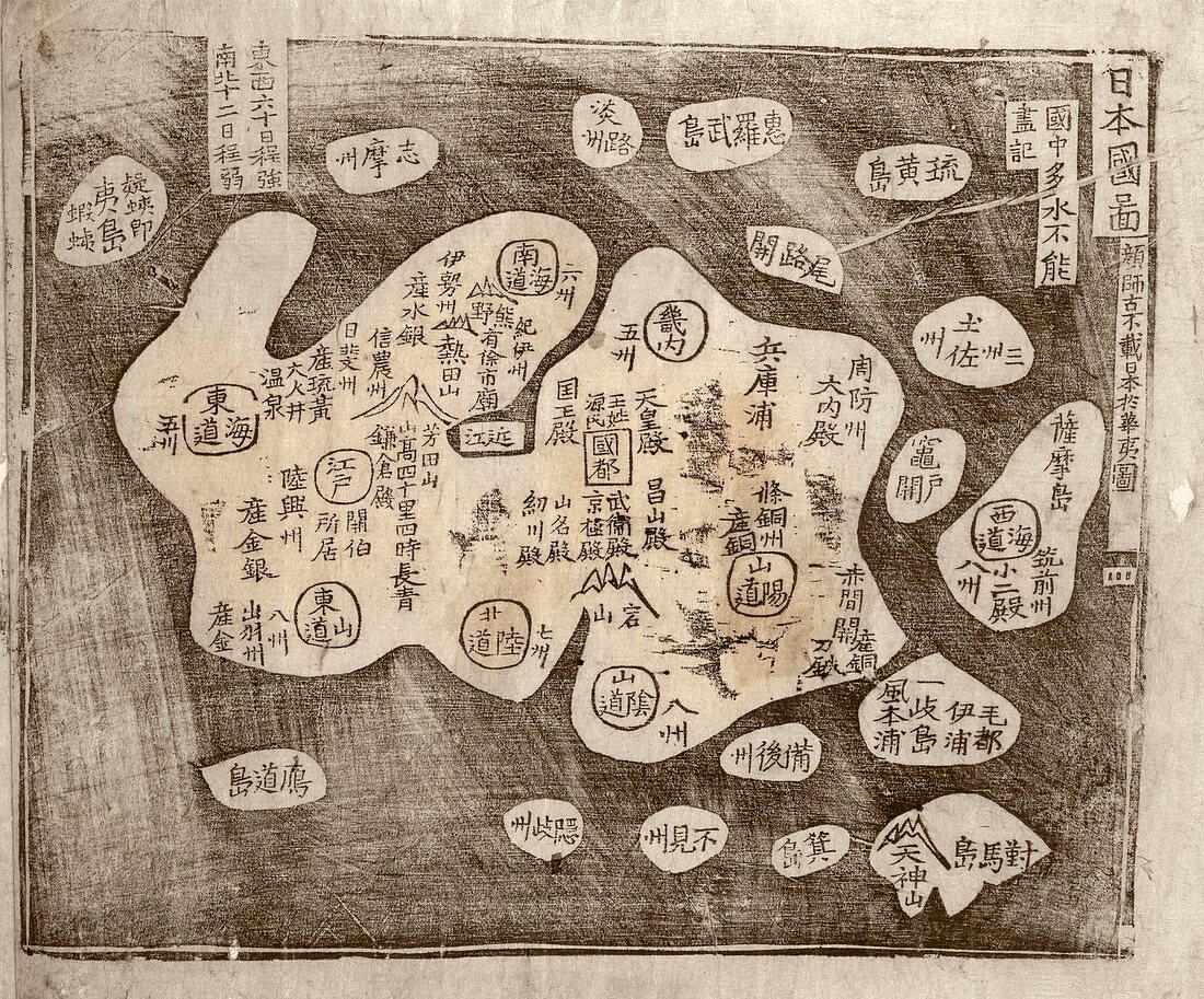
| Map of Japan. 18th-century map of Japan from a Korean atlas. This map is from an atlas titled 'Yojido' that dates from the 1760s. Such maps were produced after contact had been made with European geographers,but the designs were based on Asian traditions. Korean maps often used Chinese characters. Here,the two symbols representing Japan (Il-bon) are in the top right corner | |
| Licence : | Droits gérés |
| Crédit: | Science Photo Library / LIBRARY OF CONGRESS, Geography and Map Division |
| Taille de l’image : | 4612 px × 3827 px |
| Model Release : | Non requis |
| Property Release : | Non requis |
| Restrictions : | - |
Prix pour cette image À partir de 45 €
Produit vendu
(Calendrier, Carte postale, Carte de vœux, Impression sur textile, Packaging etc)
À partir de 45 €
Usage commercial
(Affichage, Annonce presse, Annonce TV, Carte, Digital - hors rés. sociaux, Digital - rés. sociaux etc)
À partir de 45 €
Éditorial
(Digital, Journal, Livre, Livre pratique, Magazine, Télévision etc)
À partir de 60 €
Usage non-commercial
(Digital - hors rés. sociaux, Digital - rés. sociaux etc)
À partir de 120 €
Mots clés
- 1700,
- 1760,
- 18ème siècle,
- atlas,
- aucun,
- caractères,
- carte,
- cartographie,
- coréen,
- géographie,
- géographique,
- histoire,
- historique,
- île,
- illustration,
- Japon,
- langage,
- manuscript chinois,
- monochrome,
- n/b,
- noir et blanc,
- noir-et-blanc,
- oeuvre,
- pays,
- personnages,
- personne,
- publication,
- région,
- schéma,
- XVIIIème siècle