Rebbelib stick map,Marshall Islands
Numéro d’image : 11730630
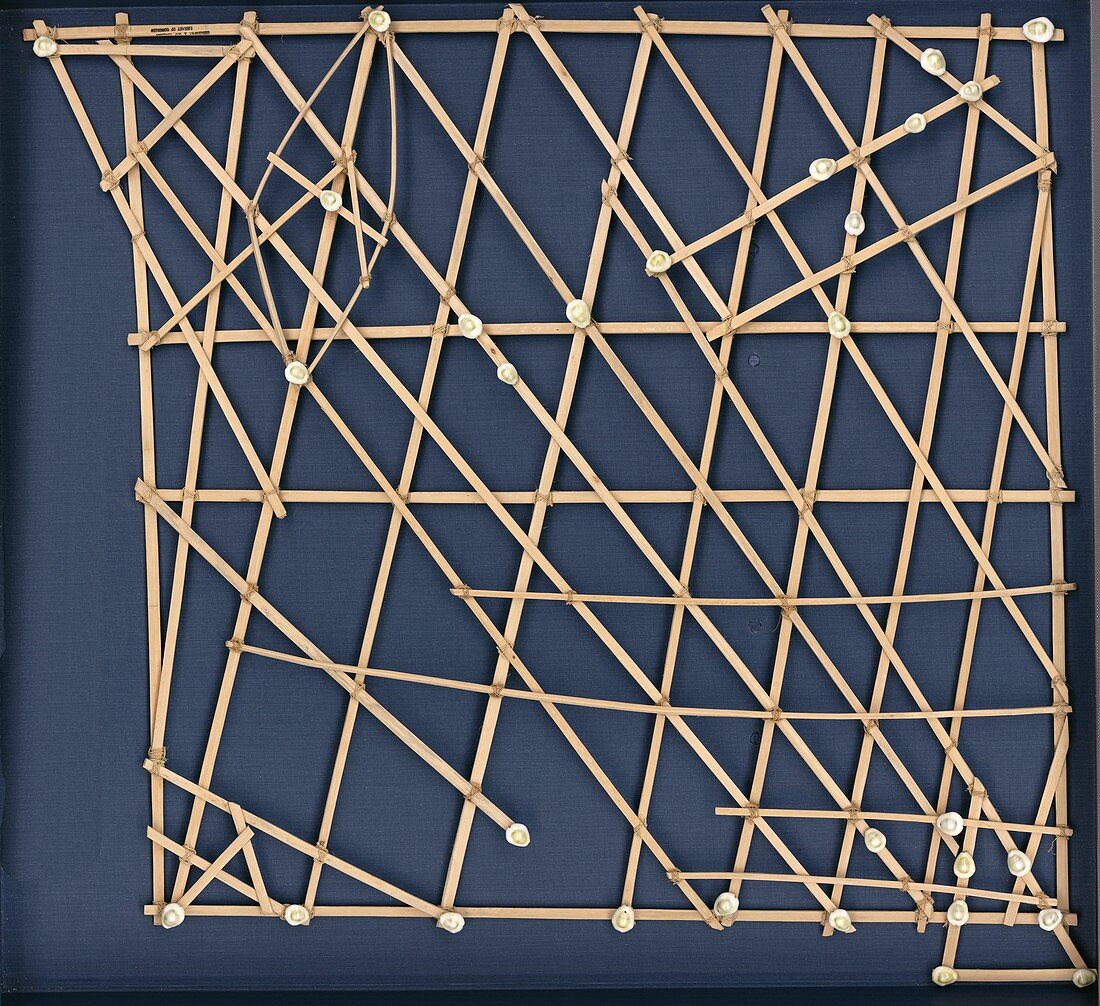
| Rebbelib stick map,Marshall Islands. Rebbelib stick charts are used by Pacific islanders to record waves and currents around atolls and island groups. The Marshall Islands are in the western Pacific,where travel at sea takes place in outrigger sailing canoes. This chart indicates sailing directions for atolls and islands in the Ratak (eastern) and Ralik (western) chains of the Marshall Islands. Seashells depict the atoll and island locations. Each straight stick represents regular currents or waves around the low-lying atolls while the curved sticks depict ocean swells around the islands and at sea between the islands. This specimen of a stick map dates from the 1920s | |
| Licence : | Droits gérés |
| Crédit: | Science Photo Library / LIBRARY OF CONGRESS, Geography and Map Division |
| Taille de l’image : | 5011 px × 4583 px |
| Model Release : | Non requis |
| Property Release : | Non requis |
| Restrictions : | - |
Prix pour cette image À partir de 45 €
Produit vendu
(Calendrier, Carte postale, Carte de vœux, Impression sur textile, Packaging etc)
À partir de 45 €
Usage commercial
(Affichage, Annonce presse, Annonce TV, Carte, Digital - hors rés. sociaux, Digital - rés. sociaux etc)
À partir de 45 €
Éditorial
(Digital, Journal, Livre, Livre pratique, Magazine, Télévision etc)
À partir de 60 €
Usage non-commercial
(Digital - hors rés. sociaux, Digital - rés. sociaux etc)
À partir de 120 €
Mots clés
- 1900,
- 1920,
- 20ème siècle,
- années 20,
- années folles,
- atolls,
- aucun,
- bâtons,
- carte,
- cartographie,
- coquilles,
- courants,
- diagramme,
- géographie,
- géographique,
- graphique,
- histoire,
- historique,
- îles,
- Iles Marshall,
- maritime,
- Micronésie,
- micronésien,
- nautique,
- navigation,
- pacifique,
- personne,
- photo professionnelle,
- photo réalisée en studio,
- Polynésie,
- polynésien,
- prise de vue studio,
- tableau,
- vents,
- XXème siècle