Map of the Northern Hemisphere,1790
Numéro d’image : 11730208
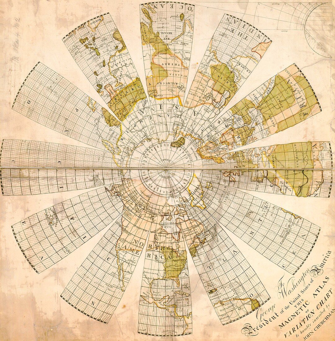
| 18th century map of the Northern Hemisphere with a dedication to George Washington,president of the USA. This is a magnetic atlas,or variation chart,that allows the magnetic variation of any location to be determined. The magnetic variation is the difference between true north and magnetic north,which varies with location and time. The map was drawn by the surveyor John Churchman (1753-1805) and first printed in 1790 | |
| Licence : | Droits gérés |
| Crédit: | Science Photo Library / American Philosophical Society |
| Taille de l’image : | 4901 px × 4996 px |
| Model Release : | Non requis |
| Property Release : | Non requis |
| Restrictions : | - |
Prix pour cette image À partir de 45 €
Produit vendu
(Calendrier, Carte postale, Carte de vœux, Impression sur textile, Packaging etc)
À partir de 45 €
Usage commercial
(Affichage, Annonce presse, Annonce TV, Carte, Digital - hors rés. sociaux, Digital - rés. sociaux etc)
À partir de 45 €
Éditorial
(Digital, Journal, Livre, Livre pratique, Magazine, Télévision etc)
À partir de 60 €
Usage non-commercial
(Digital - hors rés. sociaux, Digital - rés. sociaux etc)
À partir de 120 €