Greenland Ice Sheet
Numéro d’image : 11723063
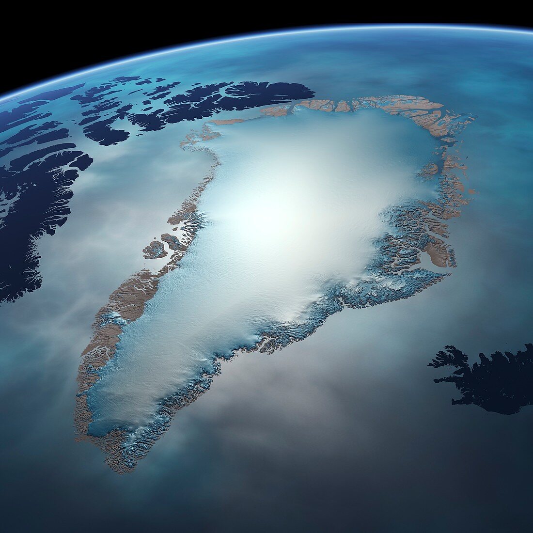
| Greenland Ice Sheet. Map of Greenland and its ice sheet,showing the surrounding areas and the coastal areas not covered by the ice. The Greenland Ice Sheet is a mass of ice with an area of 1.7 million square kilometres,reaching a thickness of over 3 kilometres,with the oldest layers from over 115 thousand years ago. This map was produced from GIMP (Greenland Ice Mapping Project) satellite radar data by the Byrd Polar and Climate Research Center,Ohio State University | |
| Licence : | Droits gérés |
| Crédit: | Science Photo Library / Pharand-Deschenes, Felix |
| Taille de l’image : | 4200 px × 4200 px |
| Model Release : | Non requis |
| Property Release : | Non requis |
| Restrictions : | - |
Prix pour cette image À partir de 45 €
Produit vendu
(Calendrier, Carte postale, Carte de vœux, Impression sur textile, Packaging etc)
À partir de 45 €
Usage commercial
(Affichage, Annonce presse, Annonce TV, Carte, Digital - hors rés. sociaux, Digital - rés. sociaux etc)
À partir de 45 €
Éditorial
(Digital, Journal, Livre, Livre pratique, Magazine, Télévision etc)
À partir de 60 €
Usage non-commercial
(Digital - hors rés. sociaux, Digital - rés. sociaux etc)
À partir de 120 €
Mots clés
- 21ème siècle,
- Arctique,
- aucun,
- calotte glaciaire,
- carte satellite,
- climatologie,
- climatologique,
- congelé,
- côte,
- côtier,
- data,
- donnée,
- du nord,
- ensemble de données,
- gelé,
- géographie,
- géographie physique,
- géographique,
- glacé,
- glacial,
- glaciologie,
- grand,
- Groenland,
- illustration,
- massif,
- oeuvre,
- personne,
- polaire,
- sciences de l'environnement,
- Sciences de la Terre,
- sciences environnementales,
- spetentrional,
- surgelé,
- verglacé,
- XX1ème siècle