The Rotz Atlas
Numéro d’image : 11674423
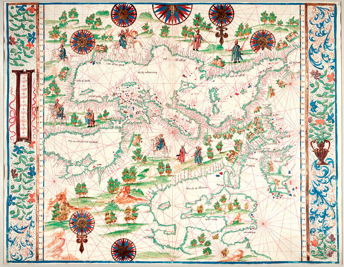
| Map of Europe,the Mediterranean Sea,and the North Coast of Africa,Whole map Map of Europe,from the British Isles and Scandanavia,to the north coast of Africa; with the Mediterranean Sea and Black Sea. Image taken from the Rotz Atlas Boke of Idrography. Originally produced in England; 1542 | |
| Licence : | Droits gérés |
| Crédit: | Science Photo Library / British Library |
| Taille de l’image : | 4743 px × 3685 px |
| Model Release : | Non requis |
| Property Release : | Non requis |
| Restrictions : | - |
Prix pour cette image À partir de 45 €
Produit vendu
(Calendrier, Carte postale, Carte de vœux, Impression sur textile, Packaging etc)
À partir de 45 €
Usage commercial
(Affichage, Annonce presse, Annonce TV, Carte, Digital - hors rés. sociaux, Digital - rés. sociaux etc)
À partir de 45 €
Éditorial
(Digital, Journal, Livre, Livre pratique, Magazine, Télévision etc)
À partir de 60 €
Usage non-commercial
(Digital - hors rés. sociaux, Digital - rés. sociaux etc)
À partir de 120 €