Sussex and Kent
Numéro d’image : 11674355
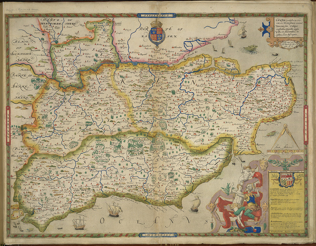
| Sussex and Kent,A map of Sussex and Kent,with parts of Essex,Buckinghamshire,Bekshire,Hampshire and Middlesex. Image taken from An atlas of England and Wales,containing 35 coloured maps,drawn by Christopher Saxton and engraved by A. Ryther,R. Hogenberg,C. Hogius,N. Reynolds,L. Terwoort and F. Scatter. Originally published in 1579 | |
| Licence : | Droits gérés |
| Crédit: | Science Photo Library / British Library |
| Taille de l’image : | 4738 px × 3689 px |
| Model Release : | Non requis |
| Property Release : | Non requis |
| Restrictions : | - |
Prix pour cette image À partir de 45 €
Produit vendu
(Calendrier, Carte postale, Carte de vœux, Impression sur textile, Packaging etc)
À partir de 45 €
Usage commercial
(Affichage, Annonce presse, Annonce TV, Carte, Digital - hors rés. sociaux, Digital - rés. sociaux etc)
À partir de 45 €
Éditorial
(Digital, Journal, Livre, Livre pratique, Magazine, Télévision etc)
À partir de 60 €
Usage non-commercial
(Digital - hors rés. sociaux, Digital - rés. sociaux etc)
À partir de 120 €