Lord Burghley's Atlas
Numéro d’image : 11674343
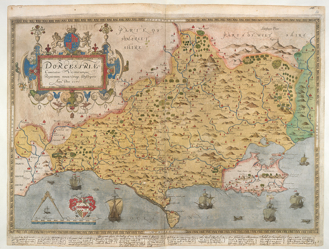
| Map of Dorset,Whole map Printed map of Dorset,from drawing by Christopher Saxton,1575. The work was undertaken for Thomas Sackville,Master of Requests,and dedicated to Queen Elizabeth I. Image taken from Lord Burghley's Atlas. Originally produced in : 1579. Illustrated by Christopher Saxton | |
| Licence : | Droits gérés |
| Crédit: | Science Photo Library / British Library |
| Taille de l’image : | 4808 px × 3635 px |
| Model Release : | Non requis |
| Property Release : | Non requis |
| Restrictions : | - |
Prix pour cette image À partir de 45 €
Produit vendu
(Calendrier, Carte postale, Carte de vœux, Impression sur textile, Packaging etc)
À partir de 45 €
Usage commercial
(Affichage, Annonce presse, Annonce TV, Carte, Digital - hors rés. sociaux, Digital - rés. sociaux etc)
À partir de 45 €
Éditorial
(Digital, Journal, Livre, Livre pratique, Magazine, Télévision etc)
À partir de 60 €
Usage non-commercial
(Digital - hors rés. sociaux, Digital - rés. sociaux etc)
À partir de 120 €
Mots clés
- âge d'or,
- anglais,
- Angleterre,
- atlas,
- carte,
- cartes,
- cartographie,
- CHRISTOPHER SAXTON,
- Dorset,
- DORSETSHIRE,
- dynastie des Tudor,
- dynastie Tudor,
- ère élisabéthaine,
- ère élisabéthaine 1558-1603,
- Europe,
- europe occidentale,
- Grande Bretagne,
- Grande-Bretagne,
- Iles Britanniques,
- les Tudors,
- maison de Tudor,
- période Tudor,
- renaissance anglaise