Japanese Buddhist world map
Numéro d’image : 11674231
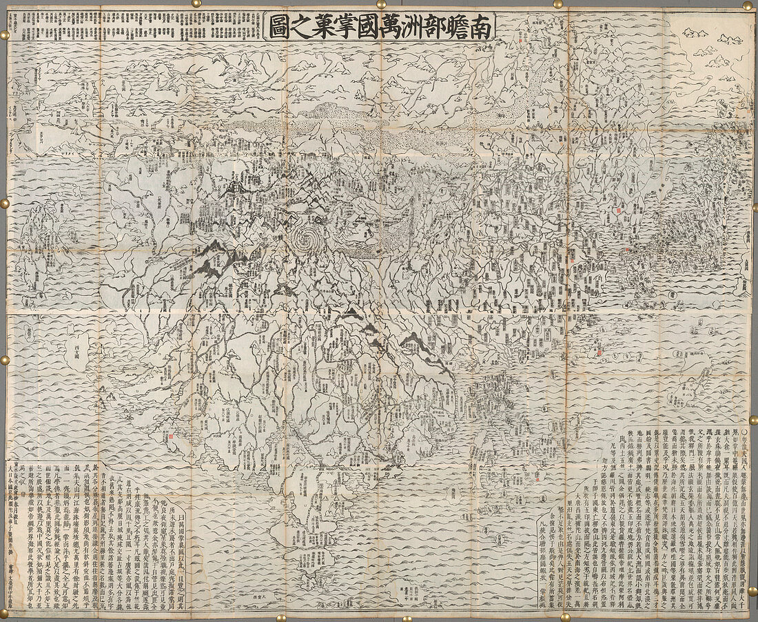
| Japanese Buddhist world map,Outline map of all the countires in Jambu-dvipa. Woodcut. Originally published in Kyoto,Obei Bundaiken,1710. Illustrated by Zuda Rokashi | |
| Licence : | Droits gérés |
| Crédit: | Science Photo Library / British Library |
| Taille de l’image : | 4617 px × 3785 px |
| Model Release : | Non requis |
| Property Release : | Non requis |
| Restrictions : | - |
Prix pour cette image À partir de 45 €
Produit vendu
(Calendrier, Carte postale, Carte de vœux, Impression sur textile, Packaging etc)
À partir de 45 €
Usage commercial
(Affichage, Annonce presse, Annonce TV, Carte, Digital - hors rés. sociaux, Digital - rés. sociaux etc)
À partir de 45 €
Éditorial
(Digital, Journal, Livre, Livre pratique, Magazine, Télévision etc)
À partir de 60 €
Usage non-commercial
(Digital - hors rés. sociaux, Digital - rés. sociaux etc)
À partir de 120 €
Mots clés
- aquatique,
- Asie,
- avec de l'eau,
- bord de mer,
- caractéristiques terrestres,
- carte,
- cartographie,
- côte,
- côté,
- front de mer,
- gravure sur bois,
- Japon,
- littoral,
- mer,
- mers,
- plage,
- relatif à l'eau,
- rivage,
- technique de prise de vue,
- techniques d'illustration,
- techniques d'image,
- techniques de photo,
- topographie