The Ohio and Muskingum Rivers
Numéro d’image : 11673925
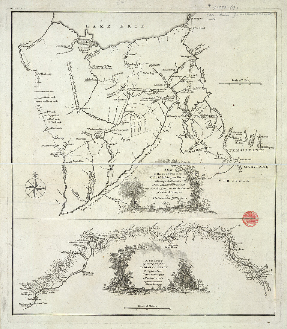
| The Ohio and Muskingum Rivers,A Map of the Country on the Ohio and Muskingum Rivers. Image taken from A Map of the Country on the Ohio and Muskingum Rivers,shewing the situation of the Indian towns with respect to the Army under the command of Colonel Bouquet. By T. Hutchins Scale of miles,60 = 50 mm. (A survey of that part of the Indian Country through which Colonel Bouquet marched in 1764,etc). Originally published in 1766 | |
| Licence : | Droits gérés |
| Crédit: | Science Photo Library / British Library |
| Taille de l’image : | 3900 px × 4482 px |
| Model Release : | Non requis |
| Property Release : | Non requis |
| Restrictions : | - |
Prix pour cette image À partir de 45 €
Produit vendu
(Calendrier, Carte postale, Carte de vœux, Impression sur textile, Packaging etc)
À partir de 45 €
Usage commercial
(Affichage, Annonce presse, Annonce TV, Carte, Digital - hors rés. sociaux, Digital - rés. sociaux etc)
À partir de 45 €
Éditorial
(Digital, Journal, Livre, Livre pratique, Magazine, Télévision etc)
À partir de 60 €
Usage non-commercial
(Digital - hors rés. sociaux, Digital - rés. sociaux etc)
À partir de 120 €