Views and plans of Royal Bay
Numéro d’image : 11673834
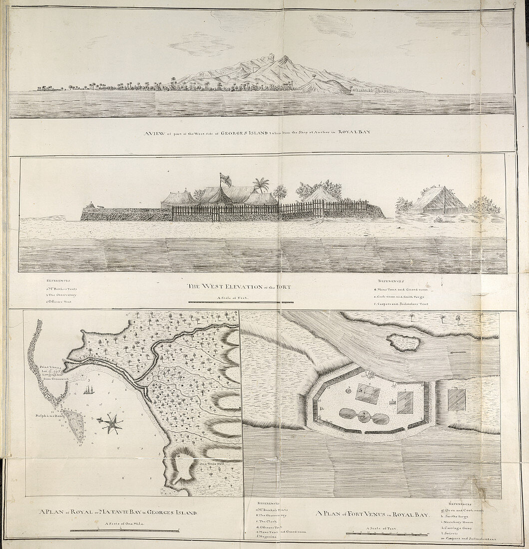
| Views and plans of Royal Bay,Whole folio Four views of Royal Bay,Otaheite Tahiti. A view of part of the west coast of George's Island,taken from the ship at anchor in Royal Bay. A view of the west elevation of Fort Venus. A plan of Royal or Matavie Bay. A plan of Fort Venus Image taken from Charts,Plans,and Drawings taken on board the Endeavour during Captain Cook's First Voyage,1768-1771. Originally published in Tahiti; 1771. Illustrated by Charles Praval | |
| Licence : | Droits gérés |
| Crédit: | Science Photo Library / British Library |
| Taille de l’image : | 4102 px × 4260 px |
| Model Release : | Non requis |
| Property Release : | Non requis |
| Restrictions : | - |
Prix pour cette image À partir de 45 €
Produit vendu
(Calendrier, Carte postale, Carte de vœux, Impression sur textile, Packaging etc)
À partir de 45 €
Usage commercial
(Affichage, Annonce presse, Annonce TV, Carte, Digital - hors rés. sociaux, Digital - rés. sociaux etc)
À partir de 45 €
Éditorial
(Digital, Journal, Livre, Livre pratique, Magazine, Télévision etc)
À partir de 60 €
Usage non-commercial
(Digital - hors rés. sociaux, Digital - rés. sociaux etc)
À partir de 120 €
Mots clés
- anglais,
- Asie,
- baie,
- bâtiments militaires,
- bord de mer,
- caractéristiques terrestres,
- carte,
- cartes,
- cartographie,
- CHARLES PRAVAL,
- chef,
- citadelle,
- complexe,
- complexe militaire,
- complexes,
- côte,
- côté,
- cuisine,
- cuisiner,
- diagrammes,
- faire la cuisine,
- fort,
- forteresse,
- front de mer,
- golfe,
- graphiques,
- JAMES COOK,
- littoral,
- plage,
- plans,
- rivage,
- royal,
- tableaux,
- topographie,
- voyage,
- voyages