Siege of Kimberley
Numéro d’image : 11673775
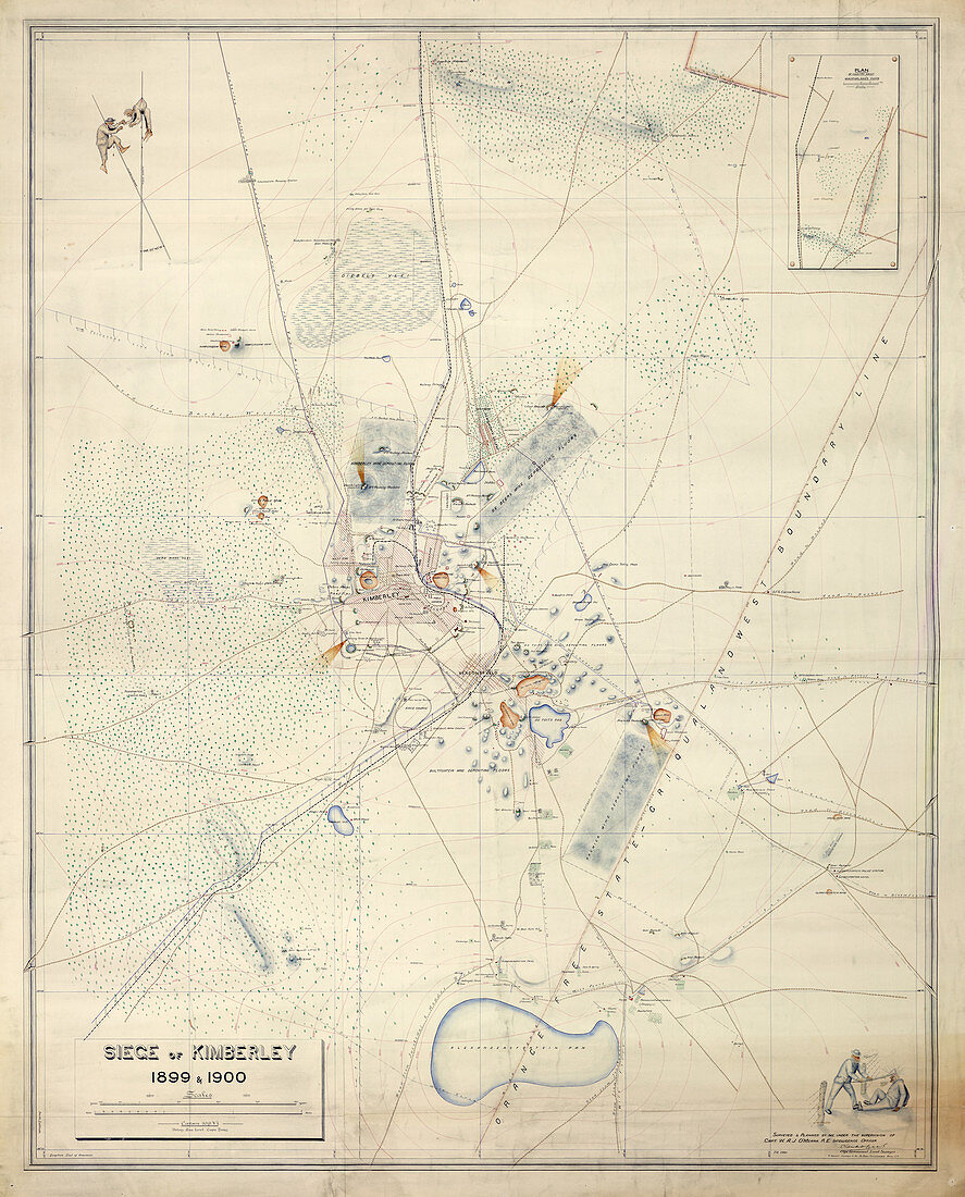
| Plan of the Siege of Kimberley,14 October 1899 - 15 February 1900; with pictorial compass points showing speared Boers. Surveyed by Colonel A.J. O'Meara,R.E,and signed by Claude O. Lucas,Cape Government Surveyor. February 1900 Originally published in South Africa; 1900 | |
| Licence : | Droits gérés |
| Crédit: | Science Photo Library / British Library |
| Taille de l’image : | 3754 px × 4655 px |
| Model Release : | Non requis |
| Property Release : | Non requis |
| Restrictions : | - |
Prix pour cette image À partir de 45 €
Produit vendu
(Calendrier, Carte postale, Carte de vœux, Impression sur textile, Packaging etc)
À partir de 45 €
Usage commercial
(Affichage, Annonce presse, Annonce TV, Carte, Digital - hors rés. sociaux, Digital - rés. sociaux etc)
À partir de 45 €
Éditorial
(Digital, Journal, Livre, Livre pratique, Magazine, Télévision etc)
À partir de 60 €
Usage non-commercial
(Digital - hors rés. sociaux, Digital - rés. sociaux etc)
À partir de 120 €