Map of Native Indian lands
Numéro d’image : 11673555
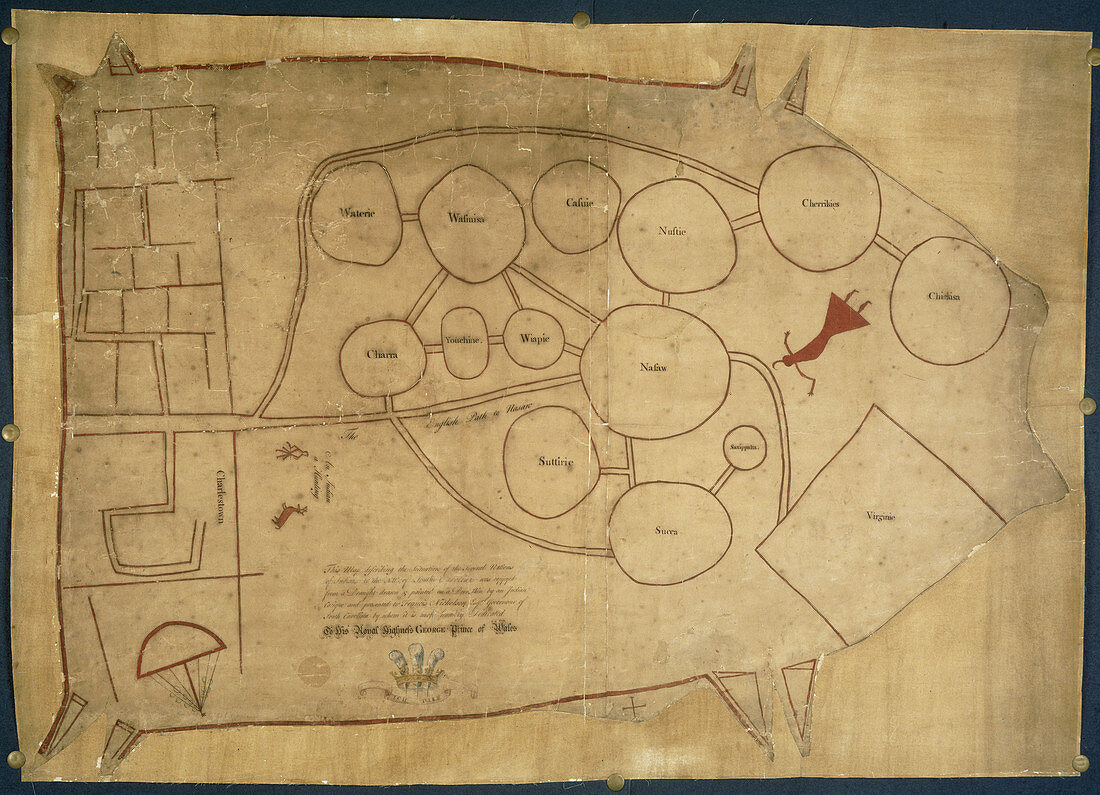
| Map of Native Indian lands,Whole map Sketch map,probably copied from a Native Indian map,illustrating with diagrams the areas occupied by the different tribes near Charlestown Charleston,in the north-west of South Carolina. Presented to Francis Nicholson,Governor of South Carolina,who dedicated it to George,Prince of Wales Originally published in N. America South Carolina; circa 1721-1725 | |
| Licence : | Droits gérés |
| Crédit: | Science Photo Library / British Library |
| Taille de l’image : | 4916 px × 3555 px |
| Model Release : | Non requis |
| Property Release : | Non requis |
| Restrictions : | - |
Prix pour cette image À partir de 45 €
Produit vendu
(Calendrier, Carte postale, Carte de vœux, Impression sur textile, Packaging etc)
À partir de 45 €
Usage commercial
(Affichage, Annonce presse, Annonce TV, Carte, Digital - hors rés. sociaux, Digital - rés. sociaux etc)
À partir de 45 €
Éditorial
(Digital, Journal, Livre, Livre pratique, Magazine, Télévision etc)
À partir de 60 €
Usage non-commercial
(Digital - hors rés. sociaux, Digital - rés. sociaux etc)
À partir de 120 €